
 Homewaters Project, an educational nonprofit in Seattle, successfully uses Geographic Information System (GIS) technology as one of its methods of connecting students to their natural and social communities.
By Todd Burley, Homewaters Project
As place-based educators, we often shudder at the notion that technology can connect people to the world around them. The very idea of sitting in front of a computer to learn about your home place seems incongruous. But Homewaters Project, an educational nonprofit in Seattle, successfully uses Geographic Information System (GIS) technology as one of its methods of connecting students to their natural and social communities.
In the foreword to David Sobel’s book Place-Based Education, Laurie Lane-Zucker defines place-based education as “the pedagogy of community, the reintegration of the individual into her homeground, and the restoration of the essential links between a person and her place.” Elementary school students must begin this process by simply developing awareness and knowledge of their local environment and community. For middle and high school students, however, appropriate education engages them in their community as active citizens.
Technology can actually be used to connect these older students to certain social and environmental issues in their community that are beyond direct experience in both time and scope. Consider:
• Population density in relation to stream health,
• Income levels in relation to pollution spots, or
• Shoreline changes over the past century.
How can a teacher bring these locally relevant large social and environmental issues to light?

Water and Community
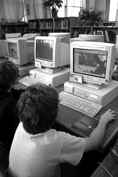
In three Seattle middle schools, eighth grade students use technology to visualize these complex neighborhoods and watershed issues in their own home place. Coordinated and created by Homewaters Project, the Water and Community GIS Program brings together real world data from local governments, volunteers from local colleges, and the GIS software ArcView to help prepare students to become active citizens.
Designed to last about a month, Water and Community engages students in the ecological and social issues of their home place while teaching them the GIS skills that professional planners use to help understand and solve such issues. Using their home watershed as the organizing framework, the students investigate water quality issues using different data layers, including:
-one that shows where nearby streams are,
-one that pinpoints leaking underground storage tanks, and
-one that displays the population density by census tract.
These line, point, and area layers can be placed over each other (like transparencies) to visualize their relationships, and together provide a basis for students to investigate questions about hydrology and water quality in their community.
Students also use GIS data to find out specific information about features such as creek names, businesses that require pollution permits, or predominant types of land cover in their neighborhood. Rather than learning about issues in far away states or countries, these students study the deeper story behind places they see everyday. Over the course of five classroom sessions, they learn information about their neighborhood that few residents ever discover. Prepared by this experience, Water and Community participants become more informed and, hopefully, more engaged future citizens.
 Making Learning Relevant
One problem with technology in education is that it can lack relevance for students. Yet the Water and Community GIS Program offers an example of how to connect students to their place using technology. When the concept of place-based education guides the application of technology, truly remarkable learning can result.
As always, a key question must be, “What is the goal?” If technology enhances the student learning experience and helps achieve that goal, technology can be a wonderful tool. For Homewaters Project, and other place-based education organizations, the goal is to connect people to their home place and engage them in their community.
As students reach middle and high school age, GIS application using local data can bring alive and clarify complex issues every community must confront — and make the issues immediate for young people as they prepare to become citizens. While every community is unique, and obviously not every educational goal can be served with technology, Homewaters Project shows that strategically applied technology can enhance place-based education.
[/password]
Todd Burley is the Outreach Coordinator for the Homewaters Project in Seattle. Homewaters can be reached at 9600 College Way North, Seattle WA 98103; (206) 526-0187 or at www.homewatersproject. org