

by Bill Hanshumaker
Hatfield Marine Science Center
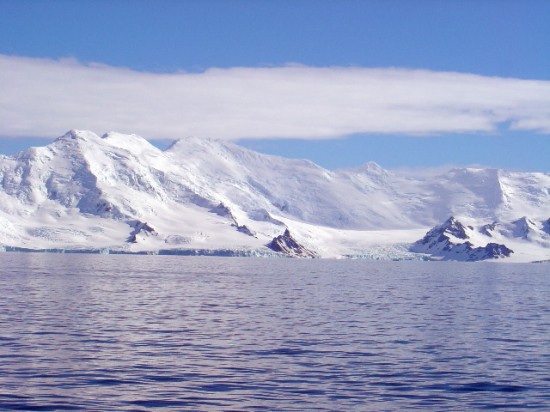
The Southern Ocean surrounds Antarctica and serves as a conduit between the Atlantic, Pacific and Indian oceans. Yet because of severe climatic conditions, much of this ocean basin remains unexplored. Polar regions play key roles in the global environment and one goal of our project is to document linkages between changes to the Antarctic ice sheet and the volcano-tectonic seafloor processes in the region. To meet the challenge for continuous monitoring in this extreme environment, researchers from the Hatfield Marine Science Center utilized the Russian icebreaker Yuzhmorgeologiya to deploy an array of Autonomous Underwater Hydrophones (AUH). This new ocean-sensor technology uses cold-water capable, deep-ocean hydrophones to record sounds generated by moving ice sheets, undersea earthquakes and volcanoes; even vocalizations from large baleen whales. When the AUH array is recovered in 2006, sounds that it has captured will enable accurate monitoring of global climate change, as well as identifying previously unknown volcanically active regions on the polar seafloor.
 Six of the seven hydrophones are located in the Bransfield Strait, a region of known geological activity near the South Shetland Islands. The first hydrophone deployment required about four hours of ship time. Every minute was needed aboard for preparation. Our marine engineer, Dr. Haru Matsumoto, was responsible for testing and assembling the hydrophones in the Geological Lab on the Yuzhmorgeologiya. It was necessary to ship the hydrophone units in parts in order to test each component before deployment. Given the time, effort and cost of this endeavor, everything needed to be double-checked to assure its successful operation.
The chief scientist, Dr. Robert Dziak, remained on deck supervising the layout of the hydrophone’s mooring equipment. This consists of a 37-inch syntactic foam float with a flashing light, connected to chain and ¾ inch nylon rope to the “Haruphone”. The Haruphone is autonomous, and needs to be recovered in order to retrieve its data. The first of these specially designed hydrophones was deployed at a 400-meter depth and attached a 5/16-inch mooring line, whose length depends on the depth of the ocean bottom at that location. This in turned is shackled to the acoustic release. The acoustic release frees the hydrophone from the anchor when the recovery vessel broadcasts a coded frequency of sound underwater. The acoustic release is connected by wire and chain to an 850-pound railroad wheel, which serves as the anchor.
 The weather was unexpectedly ideal for the deployment our hydrophones. With the calm seas, deck work preceded quickly. A short length of chain and ¾ inch nylon rope is attached to a yellow, syntactic foam float. Then the large “A” frame crane on Yuzhmorgeologiya’s stern lowers it into the ocean. As the ship slowly steams forward, the nylon rope unwinds from a large spool: the rope length depends on the depth at this location. The acoustic release is then joined to this assembly with wire and chain. The heavy railroad wheel anchor is the last part added and lowered over the side by the “A” frame. Finally, the entire apparatus is free from the ship: a long length of float, hydrophone, acoustic release and mooring anchor that will hopefully withstand the rigors of an Antarctic winter. Because each hydrophone was deployed in a different depth, each mooring was unique. To avoid error, the mooring diagram was displayed prominently on deck, and was referred to continually.
 Before departing to the next deployment, the hydrophone mooring location had to be calibrated. Researchers use the ship’s Global Positioning Satellite (GPS) system as it moves in a large circle to triangulate the exact position of the transponder located in the acoustic release. Without knowing the precise coordinates of each hydrophone, scientists will not be able to calculate the exact location of underwater seismic disturbances that they expect to record.
The final hydrophone was installed in the Drake Passage, a storm-ridden stretch of ocean between South America and Antarctica. The first order of business was to conduct an acoustic survey to locate level seafloor. This helped to assure that the hydrophone’s heavy railroad wheel anchor would stay in place. At over 3500 meters, this was our deepest deployment of the cruise. After stopping to lower the syntactic foam float, the Yuzhmorgeologiya steamed forward at 2 knots to play out 3000 meters of nylon rope, before pausing again to attach the acoustic release. We then returned to our original location to drop the anchor. The anchor required over 20 minutes to reach bottom and landed within 150 meters of the projected location. After verifying its position with GPS, the captain turned the ship and headed back towards Antarctica.
The sounds detected from these hydrophones are expected to tell us about global climate change. The main idea is that when ice sheets and icebergs move, they make a lot of sound that can be heard on our instruments in the ocean. If global ocean temperatures are increasing, the warmer ocean water will cause the ice sheets and icebergs to break apart, causing an overall increase in sound (noise) in the ocean that we will detect. This overall increase in noise will be separate from ice noise caused by seasonal changes in temperature.
 The pattern of seismic disturbances can also be used to predict tsunamis. As geologists say, the past is the key to understanding the present and the future. Understanding the past, long-term seismic behavior of a fault can gauge what the behavior of the fault will be now and in the future. If the fault zone has produced large earthquakes and tsunamis in the past, it will again in the future.
More information on this research from Antarctica can be found in my daily logs and images filed at two different sites:
http://seagrant.oregonstate.edu/extension/hanshumaker.html
and
http://oceanexplorer.noaa.gov/explorations/explorations.html
 Bill Hanshumaker is responsible for many of the exhibits and events at OSU‘s Hatfield Marine Science Center in Newport, where he not only designs exhibit material, but also uses it to study how people learn in an aquarium-science center setting. He also serves as an educational consultant to researchers at the HMSC and at OSU, and to state and federal agencies interested in developing interpretive materials to explain science to the public. And he conducts hands-on workshops in topics ranging from marine animal dissection to fossil identification for HMSC visitors, classes and special events.
Projects and areas of interest include: “Sounds from the Southern Ocean 2006,” blogging an Antarctic research voyage. “Sounds from the Southern Ocean” NOAA research voyage (2005); marine science public education programs.