
by editor | Dec 28, 2025 | Data Collection, Environmental Literacy
How do we train educators to successfully interface technologies with the outdoor experiences that they provide their students?
by R. Justin Hougham,
Marc Nutter,
Megan Gilbertson,
Quinn Bukouricz
University of Wisconsin – Extension
Originally published January 2020
 Technology in education (ed tech) is constantly changing and growing in impact in classrooms across the globe. While ed tech holds great promise for closing achievement gaps in sectors of the education community, it remains yet to be seen how this will truly live up to its potential (“Brain Gains”, 2017, July 22). Ed tech is anticipated to grow to a $120 billion market by 2019, which will largely be spent in software and web services. How might we hope to see this show up in out-of-classroom field experiences?
Unaddressed in these articles and what we explore here are the specific impacts that the conversation of technology in environmental education brings as well as a case study that shares strategies we have found to be effective when an education considers the merging of hardware (inquiry tools), technology application in professional development, and web-based collaboration tools. Important questions for environmental education ask include How does this scale for education for the environment? What considerations need to be taken to ensure that investment works? How would we know if it does? How do we train educators to successfully interface technologies with the outdoor experiences that they provide their students? In an article published here in Clearing in 2012, we explored the instructional framework for merging field based science education with mobile pedagogies in the framework entitled Adventure Learning @ (Hougham, Eitel, and Miller, 2012). In the years since, this model has informed a collection of hardware kits that supports the concepts in AL@ as well as an examination of the questions outline above, these hardware kits are called Digital Observation Technology Skills (DOTS) kits.
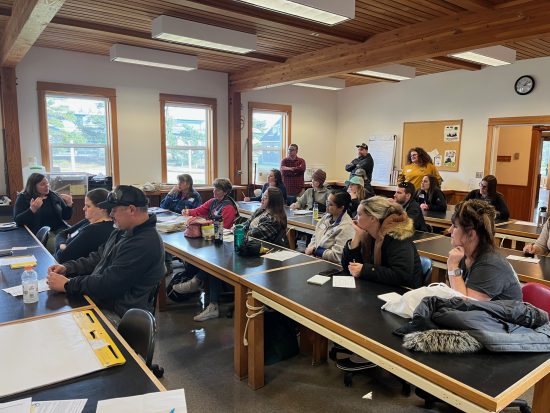
In the middle fork of the Salmon River in Idaho you’ll see Steelhead, rushing rapids and hot springs that all tell the story of the landscape. Similarly, along the Wisconsin River, you will see towns, forests and fields that have a link to the industries that have shaped the state over the last 150 years. If you’re in the right spot at the right time, you can find inquisitive young people and bright yellow cases filled with gadgets taking data points and crafting Scientific Stories about the watersheds in their state. Regardless of whether it is a wild river or a small tributary outside a schoolyard- scientific stories wait to be told in these places and technology that is appropriately considered helps unlock and share these experiences.

A naturalist assists youth with a water quality test while on a canoe trip. Photo credit: DOTS participant.
In a world where technology is almighty, wielding digital literacy is practically a requirement in our understanding of just about everything. The students of today are able to navigate through web pages and apps with ease, information at their fingertips like never before. Here, we can find ourselves removed from that information, disconnected from those data sources and collections, stifling our desire to wonder and inquire more. By investing in digital tools that can enhance inquiry of the natural world, educators can bridge this divide of both information and the ability to be a primary data collector. In equipping students with touchscreens and interfaces familiar to youth of today, they are able to partake in not only real world application of scientific observation, but also experimental design and efforts moving toward the future.
Young people in Wisconsin have been contributing to the development of this idea of digital data collection and inquiry, through DOTS. The DOTS program has been developing in Wisconsin since 2014, engaging both youth and adult demographics in digital literacies, and connecting the dots from data collection to inquiry and analysis. By involving youth in the visualization and comparison of their data collections, they are able to begin to accomplish higher order learning such as developing their own hypotheses and synthesize the meaning of their findings. DOTS has been developed for students in 4th through 8th grades but has been modified for audiences in 2nd through high school, including adult learners, continuing education, and professional development.
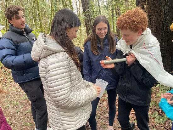
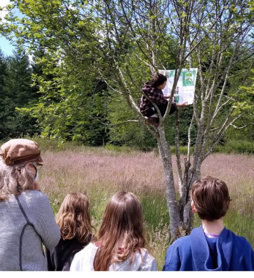
Case studies of this application vary widely in scale, location and content. Currently DOTS kits are used in Idaho and in Wisconsin by youth to examine water quality. A full-scale implementation is underway currently in Wisconsin to connect youth from many different watersheds. Held this past August, the Wisconsin Water Youth Stories Summit brought together students from across the state of Wisconsin who are interested in not only environment and ecosystems, but also water quality and sharing their “water stories”. Supported by an EPA grant, this Summit was a culminating experience for many of the youth, getting to collect and share their findings over their 3 day period at Upham Woods Outdoor Learning Center (Grant Number: EPA-00E02045). This two year grant has trained and equipped educators with DOTS tool with an emphasis on water quality monitoring. Throughout the year, youth from around Wisconsin collect data and share their findings with others in real time on the web. At the Water Stories Summit, each group brought their DOTS kit to explore the environment and compare collected data sets. This experience not only brought together young scientists with a vested interest in the future of water, but also allowed students to share stories of local water quality that affects their own communities around the state.

A student uses a water quality test to find the amount of phosphorus at a Wisconsin River location. Photo credit: DOTS participant.
Many shared stories about urban run-off pollution, such as lawn fertilizers and road salt, E. coli contamination, and they discussed the ways in which humans alter natural waterways. At the end of their experience one student said they learned that, “science is being precise and unbiased about nature and numbers.” Another student said of a different Upham experience, “We went to Blackhawk Island for our project. The tools helped us take photos of what was under the rock. The tools help to see what animals were living there. We came up with a lot of new questions after we did our research and we can’t wait to find out things like, if the temperature affects what animals we will find living under a rock, and what animals live at different depths.” Through these collaborations of student generated data, participants were able to make connections between each other and drive further inquiry questions such as how to improve water use and consumption, and how the water affects all other life.
While the kits themselves are certainly an enhancement to a variety of curriculum, the training that accompanies the deployment is just as important as the tools themselves. Educators that partner on DOTS projects are supported with (1) Equipment, (2) Training and (3) a Web platform for collaboration. It is the interrelationship between the inquiry tools, inquiry methods and inquiry artifacts that provide the support for transformative outdoor science experiences.
A DOTS kit consists of a select set of digital tools to equip youth and educators with everything they need to take a basic data set of an ecosystem and microclimate. Contained in a water-proof, heavy-duty case, the tools selected are chosen for their utility, cost effectiveness, and ease of use. Any suite of tools can be selected for an individual’s classroom purposes, this is first and foremost, a framework to scaffold inquiry and observational skills. DOTS users gain field experience with hand held weather stations, thermal imagers, digital field microscopes, GPS units, and cameras to contribute to local citizen science monitoring (Hougham and Kerlin, 2016). A DOTS program training is facilitated by program staff and has evolved over time to include these six goals. While these are used in DOTS, nearly any technology implementation would benefit from these goals being outlined.
- Establish functional and technical familiarity with DOTS Kit hardware
- Orientation to DOTS Kit web interface, data uploading, and site visualizations
- Examination of mobile, digital pedagogies in historical as well as applied contexts
- Advance instructional capacities in application of observation and inquiry facilitation applicable to experiences outside the classroom
- Production of digital artifacts that contribute to Scientific Storytelling
- Facilitation of initial curricular design considerations for integrating kits into existing programs
After the training, educators have access to a suite of tools that can be lent out for deeper science connections in outdoor spaces. Further, trained educators can use grab-and-go lessons from the project website to launch the concepts with their students and watch videos produced and hosted on the site that provide further instruction on applications of the tools.
Lastly, a web-based collaboration platform is hosted to support the development of additional inquiry. To continue this mission of enhancing student inquiry and promoting collaboration, data sets can be uploaded to an online public access platform. As users enter their data online, the map displays in real time the coordinates and information of each data point. Viewers can easily navigate a Google map with their and other’s data points for comparison and post-experience observation. This immediate viewership not only falls in line with today’s student’s understanding of a fast-paced, immediately available world, but also allows no stagnation in the learning process as inquiry can continue instantaneously. Through engagement by use of digital tools collecting data in the field, reflection on process and methods through data entry into the web-based model, and through analysis and refinement of hypothesis for further inquiry, students take ownership of their data and have a voice in sharing their discoveries with others. These inquiries have been qualified in the DOTS programming through use of a “scientific story”.
The scientific story helps to build connection between qualitative and quantitative data and their respective ways of understanding. As humans we have told stories for millennia to entertain, educate, and remember. Combining these elements of storytelling with the scientific method of developing hypotheses and data collection, a story is created to share. These stories are generally 3-5 sentences and include photos taken by camera and tools such as the handheld microscope and thermal imager. In taking a closer look with digital tools, a deeper appreciation is gained and honed in on through these scientific stories and it is through these words that we can harness stories in what they do best: share. They can be digitized and easily shared across social media platforms, creating interest in the environment and science in family and community members.
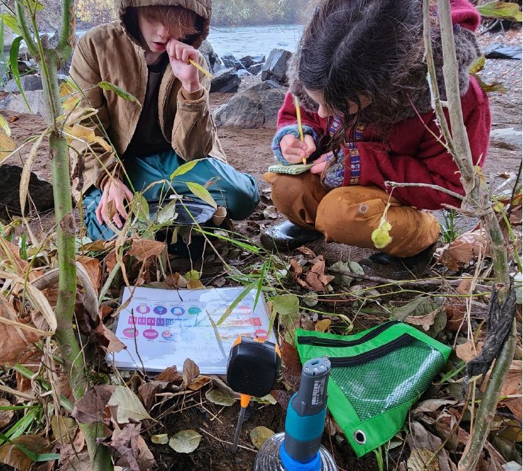
This story written while at Upham woods during the aforementioned Water Stories Summit, and describes the location and inquires the youth had.
We investigated two different locations as a part of the water study blitz at Upham Woods. The first location was the Fishing shore on the Wisconsin River, and the second location was a stagnant inlet only 100 feet away. We noticed several differences between the two locations. We wanted to know more about the animal life in both locations. What kind of animals live in these habitats that we couldn’t see during the blitz? What would we find if we studied the location where the Fishing Shore and Inlet connect?
This story highlights the questions students wanted to investigate further and spurred their desire to continue comparing locations in the context of animal life. Another story from the Water Stories Summit illustrates a group of high school students making connections between ideas and places.
When doing the data blitz at camp, we tested water for all kinds of factors (pH, Conductivity, Salinity and others). The cool thing we noticed was the differences in PH levels of the water that equaled a 9.49 level that makes water a base. This reminded us of what would happen if water had a unbalanced and non neutral PH level, that was out of control… One example of this is a sulphur pit, like in Yellowstone national park. The pH of this water is as low as 1.2, which is almost equivalent to battery acid.
By encouraging students to develop their own scientific story, they create a deeper connection with that place and nature in general. This connection evolves to a jumping off point for further inquiry and hypothesis development which can be fleshed out into full empirical science studies or harnessed into environmental service projects. Additionally, as data sets can be shared, these students in Wisconsin can use the data collected in Idaho to further their hypotheses and promote scientific collaboration.

A naturalist teaches an Escuela Verde student how to take a water quality reading. Photo credit: DOTS participant.
Throughout the use of this approach research suggests that digital tools should be adopted in environmental education whenever possible (Hougham et al., 2016). To assess participant perspectives, DOTS uses a modified Common Measures instrument (National 4-H Council, 2017) to examine student attitudes towards technology and towards nature. In a 2015 study conducted by the DOTS project research team (Hougham et al., 2016), students where engaged in two iterations of an environmental studies curriculum- one was with traditional analogue toolsets and one was with digital toolsets. In an analysis of pre/post-test evaluation responses (n= 135), students showed statistically significant and positive shifts in attitudes towards technology, the use of technology outdoors, and towards investigating nature. In a review of the data from DOTS users for both profession development and youth workshops (n=71), it was found that 97% of participants of all ages agreed or strongly agreed that they “better understand how science, technology, or engineering can solve problems after using the DOTS tools”, and 89% said they agreed or strongly agreed that they “liked learning about this subject”.
This survey data provides insight on scaffolding and curiosity building techniques. In this way, it was found that lessons on observation were most useful when they began with broad scale observations and students were invited to make more focused observations. This system allows for students to explore a part of the world that they find interesting, making them more invested in a narrative authentic to them. The practice of up close observation is nothing new in environmental education, notably Adventures with a Hand Lens was published in 1962, advancing outdoor science instruction to engage the learner in their own investigations of the world up close. Today, this observation scaffolds easily onto data collection, with students studying parts of the ecosystem that they find interesting with encouragement to find how these seemingly individual pieces coalesce into a larger system.
In moving environmental education into the digital age, educators should look to empower youth with the tools and responsibility to examine their surroundings, and in encouraging youth to take and use technology outside, educators can capitalize on students collecting their own data sets to develop deeper, more meaningful inquiry questions. And when they can begin developing their own questions that they want to answer rather than following a worksheet or handout, the exploration becomes that much more desirable and satiating. Those young people wielding handheld weather stations and thermal imagers on the Salmon River or on the Wisconsin may appear to be kids collecting some information for science project, but don’t be fooled, the next generation of scientists and scientific thinkers is out there, already developing their inquiries into the natural world.
References
- Brain Gains. (2017, July 22). The Economist. Retrieved from https://www.economist.com/news/leaders/21725313-how-science-learning-can-get-best-out-edtech-together-technology-and-teachers-can
- Headstrom, R.. (1962). Adventures with a Hand Lens.
- Hougham, R. J., Eitel, K. B., & Miller, B. G. (2013). AL@: Combining the strengths of adventure learning and place based education. 2012 CLEARING Compendium (pp 38-41).
- Hougham, J. and Kerlin, S. (2017). To Unplug or Plug In. Green Teacher. Available at: https://greenteacher.com/to-unplug-or-plug-in/.
- Hougham, R., Nutter, M., Nussbaum, A., Riedl, T. and Burgess, S. (2016). Engaging at-risk populations outdoors, digitally: researching youth attitudes, confidence, and interest in technology and the outdoors. Presented at the 44th Annual International Symposium on Experiential Education Research, Minneapolis, MN.
- National 4-H Council. (2017). Common Measures 2.0.
- Technology is transforming what happens when a child goes to school. (2017, July 22). The Economist. Retrieved from https://www.economist.com/news/briefing/21725285-reformers-are-using-new-software-personalise-learning-technology-transforming-what-happens
Dr. R. Justin Hougham is faculty at the University of Wisconsin- Extension where he supports the delivery of a wide range of science education topics to K-12 students, volunteers, youth development professionals, graduate students, and in-service teachers. Justin’s scholarship is in the areas of youth development, place-based pedagogies, STEM education, AL, and education for sustainability. See other content by this author.
Marc Nutter manages the facility of Upham Woods Outdoor Learning Center located in Wisconsin Dells, WI which serves over 11,000 youth and adults annually. With the research naturalist team at Upham Woods, Marc implements local, state, and federal grants around Wisconsin aimed to get youth connected to their local surroundings with the aid of technology that enhances observation.
Megan Gilbertson is currently a school psychology graduate student at Southern Illinois University – Edwardsville. While working at Upham Woods Outdoor Learning Center, she collaborated on grant funded projects to create and curate online data platforms for educational groups and facilitate programs for both youth and adults on the integration of technology with observation and inquiry in environmental education.
Quinn Bukouricz is a research naturalist involved with technology-integrated programming statewide, funded on grants and program revenues. He is also responsible the creation and care of programmatic equipment which includes the “Digital Observation Technology Skills” kits, and the implementation of grants.

by editor | Sep 20, 2025 | Data Collection, Environmental Literacy, Experiential Learning, Forest Education, Inquiry, Integrating EE in the Curriculum, Learning Theory, Marine/Aquatic Education, Questioning strategies
Building a Community: The Value of a Diack Teacher Workshop
Teachers are being asked to do more than ever before. We are inundated with meetings, grading, analyzing data and curriculum development. The idea of taking kids outside to do field-based research can be daunting and filled with bureaucratic hurdles. Given all this, why should we take our precious time to implement this new type of learning?
by Tina Allahverdian
 It is a warm summer day at Silver Falls State Park and a group of teachers are conducting a macroinvertebrate study on the abundance and richness of species around the swimming hole. The air is filled with sounds of laughter from children playing, parents conversing on the bank, and the gentle babble of the stream below the dam. The teachers, armed with Dnets, clipboards, and other sampling equipment, move purposefully through the water collecting aquatic species. Being a leader at this unique workshop, I am there to support the teacher’s inquiry project and also help brainstorm ways to bring this type of work back to their classrooms.
The buckets on the bank soon host a variety of species like water beetles, caddisflies, and stonefly nymphs, offering a snapshot of the rich biodiversity in the stream. We teachers sit on the bank, peering into the tubs, magnifying lenses and field guides in hand. We fill out data collection forms and discuss our findings. On this particular summer day, several young children at the park gather to see what we are doing. Their curiosity is piqued by the idea of discovering the hidden inhabitants of the aquatic ecosystem they are swimming in. The teachers and I patiently explain the project to the children and their parents. While some of the crowd goes back to swimming, two little girls stay for over an hour to help identify species. Later, while we pack up a mother stops to thank us for including her daughter in the scientific process. She shares that discovering the magic of the stream with us is her daughter’s idea of a perfect day. This moment is a testament to the power of experiential learning and the unexpected magic that can happen when we take learning into the field.
After the field work is completed, we all gather back at the lodge to create posters and present our results to the rest of the workshop participants. Based on individual interests and grade levels, teachers work in small groups to analyze their data and share their conclusions and questions. There are various topics that groups are curious about — from lichen or moss, to bird behavior and effects of a recent fire on the tree species. Teachers take on the work of scientists so they can get a feel for the experience their students will have in the future.
 Teachers often want to backwards plan, knowing the end product their students will experience and learn. But this type of scientific inquiry requires us to let go of control so that students can ask authentic, meaningful questions that are not yet answered. Teachers come to learn that teaching the process of science is often more valuable than teaching the content. They are engaging in the work of true scientists and learning how to be curious, lifelong learners along the way. Being a part of inspiring projects and trips such as these is an experience that teachers, students, and even parent volunteers will remember for years to come. As an upper elementary teacher myself, I often hear about the power of our work when families come back to visit and reminisce about their time in my classroom. I know that this work will impact future generations and their enthusiasm for science learning. Not only that, we are teaching students to do, read and understand the work of a scientist so they can make informed choices in their adult lives.
Every time I help lead this workshop, I witness a transformation among the participants over the course of the three days. On the last day we give a feedback form which is always filled with so much enthusiasm for taking the learning back to the classroom and to colleagues; I often hear this is the best professional development they have experienced in a long time because it is so practical and hands-on. One of my favorite parts about the Diack field science workshops is witnessing the teacher’s excitement for learning about nature that I know will be passed on to students back in the classroom. Twice a year we meet at a beautiful location in Oregon where teachers from many different districts have the opportunity to carry out the mini-inquiry project and plan curriculum that promotes student-driven, field based science inquiry for K-12 students.
Perhaps one of the most significant outcomes of the Diack Ecology Workshop is the formation of a community of educators passionate about outdoor learning. Teachers exchange ideas, share success stories, and collaborate on developing resources for implementing field-based inquiry projects. They share ideas across grade levels to get a sense of where their students are going and have come from. This sense of community not only strengthens the impact of the program but also creates a support network for educators venturing into the world of environmental education. I always leave the workshop inspired by the creativity, collaboration, and joy from teachers. It is one of my favorite parts of the summer and I would encourage anyone who works with students to come join us and experience the magic.
 Tina Allahverdian is passionate about connecting students with science in the natural world. When not teaching fifth graders, she can be found reading in a hammock, kayaking through Pacific Northwest waters, or hiking in the mountains. She currently teaches in West Linn, Oregon, and resides in SE Portland with her husband, twin boys, and their dog, Nalu.

by editor | Sep 20, 2025 | Conservation & Sustainability, Critical Thinking, Data Collection, Environmental Literacy, Experiential Learning, Inquiry, Place-based Education, Questioning strategies, Student research, Teaching Science
Instilling a culture of caring and fieldwork in a Montessori adolescent program
by Jonathan Erickson
Metro Montessori School
Portland Oregon
One thing that drives most educators is the hope that we are guiding students who will ultimately care about the work that they do and care about the world in which they do it. Remembering this should be a sort of thesis for all of the planning and action that follows. The work we do as teachers should help students develop into people who value themselves and the effort they put forth.
Through this writing I hope to answer the questions: “How do we best instill a culture of caring in the learning community?” and “How does fieldwork and ecology connect to other areas of social development?”
Teachers and Guides need to strive to create immersive social and scientific experiences for students, just as we would if we hoped for them to gain mastery a new language. We need to make space for students to dive deeply into valuable work so that they will not feel like “work” is just a four letter word, but will realize that it can feel good and serve a greater purpose.
We’ve all stumbled onto those perfect moments where we observe students in flow, where they are finding joy in their work and satisfaction in the process as much as the result. How can we make these moments more commonplace?
I am working towards a cultural shift at my own school. Saying it like this implies that the movement would be larger than one teacher and bigger than one class. After all a culture outlasts a tenure. I believe that we can intentionally plan and drive this change by designing and supporting long-term, project-based fieldwork rooted in discussions of current events and personal values.
Caring for natural resources and spaces

After completing a seminar reading about learning to see, this student was inspired to walk slow and carry a hand lens.
My students are adolescents. As such, they are beginning to view themselves as part of a larger world community, and they are getting more and more emotionally invested in what they see and hear from their peers, parents, social media, and the news. To be frank, what my students witness every day directly or indirectly is pretty frightening and truly merits mediated discussion. So we allow time in our learning community for students to debrief what the world is throwing at them. That said, as the adults in the workspace, we must impart a sense of hope for positive change, as young adults can easily fall victim to despondency and gloom.
The above paragraph could be a jumping off point for scheduling more service work, getting politically involved, becoming a “Green School”, discussing and understanding mental health issues, or countless other initiatives. Any work in the school that is inspired by hope for a better future is meaningful work, and hopefully we can make time for all of it. When it comes to the environmental crisis facing our world however, the entry point is in ecosystem experiences. Students will care for what they understand, and they will move towards understanding with ecological field study.
Practical lessons for us all
How can ecological field study find a place in an already full curriculum? That is just one of the challenges that I and others have faced while trying to include big projects and studies in our yearly work cycle.
Working in an independent Montessori adolescent program means that there is an administrative and institutional commitment to deep work. In my case it also means flexibility since, while we are accredited by the Western Association of Schools and Colleges, we aren’t beholden to state, district, or school board mandates. Dr. Montessori placed emphasis on following the innate interests and natural tendencies of children; which we’re doing when we take them outside and ask them to be curious. This is what we are doing when we allow students to take weeks or longer to study something that may not be discovered in a textbook or online.

A student discovering that moss isn’t just moss. Samples will be used to see if these mosses support different CO2 emitting organisms and which contribute most to the pH of runoff.
Onboarding
Student-driven projects of depth have always been a part of our students’ experience, so I don’t want it to seem like this piece is missing in our curriculum, but ecological field study is a new avenue, and I do not want it to seem ephemeral; I want it to run through all the work we do in a school year. Since I work as part of a team, it takes good communication and collaborative planning to pull this initative through.
We are not a large ship, but we are still a ship, and when we alter direction we need more than one person committed to the change. Because scheduling fieldwork will likely impinge on the plans of other guides and teachers, loop them into the work and get them excited about the possible application and integrations between science, math, and literacy disciplines. I think that most teachers like to get excited.
We are early in the shift, but I have arranged for co-teachers to join me in a field science professional development opportunity next summer hosted by the Diack Ecology Education Program and Jane Goodall Environmental Middle School. This 3-day workshop will give us the chance to do the work of our students; transforming our curiosity into a scientific question and collecting data and observations to possibly support our hypotheses. We don’t get to practice what we teach often enough in the classroom as we get bogged down in student management, record-keeping, and the like. It will be refreshing to feel the way our students feel when they are immersed in nature and are driven by curiosity. This workshop will also give the teaching team a chance to collaborate and find ways to make fieldwork a reality with our school’s unique situation.
How to plan
The culture of caring surrounds the individual work cycles like an atmosphere. Ensuring that the work cycle will align with the program goals, such as they were stated in the above thesis, means students will experience continuity in teaching philosophy and predictability in their work.
My teaching team plans “work cycles” not discrepant units, since they continue and flow into each other through the years. Students are already familiar with the ways that knowledge and skills find application across the work day. For example, understanding how plants rely on mycorrhiza and nutrients might inform the potting soil that they buy for the school garden. Understanding how human activity affects runoff might alter how students discuss environmental case studies in ethics.
Even with a willing culture and total buy-in from all the invested parties, time is still at a premium every day in the learning space and with its scarcity, there is a need for intentional planning. My goal with this schoolwide shift is to be able to have work flow into work in logical and obvious, though sometimes unexpected, ways. I want interrelationships between content lessons and activities to feel mutualistic in nature.
To be certain, there are countless ways that educators organize their ideas and put them into action; when I draft a learning cycle plan of this “big work,” I consider three periods or stages. The first period contains the key lessons and the important foundational content that the future work will build upon. The second period contains the independent student work and research, while the third period finds students presenting their work in some formal manner. All this is followed by professional reflection and the chance to begin again with a new cohort. Students also have the opportunity to continue inquiry work in our learning spaces for multiple years which allows them to build on and enhance their previous study.
Using tools that we have in our STEM space, students are inspired to analyze forest soil and compare with compressed soil of the trail. They will see if forest soil can host more nematodes, an organism that they are excited to have learned about.
First Period
Note to self: You know what’s best, but listen to student feedback as you enter into content lessons. If students get to be drivers of the learning, they are invested in the outcome.
This year, I wanted to begin with an extended amount of time just spent in nature, partially unstructured and casual: a sort of “site safari” to see what is and imagine what is possible. This was a time for work to call out to the student. These outings can be somewhat challenging for my school since we are located in downtown Portland, Oregon, but they are not impossible. It is worth it to take time to visit the outdoor workspace if just to remind students that these areas exist and need to be preserved.
This past fall, the entire student body came to the forest for journal work, readings, break-out groups with specialists, observations, discussions, chances to practice scientific illustration, etc.. We de-briefed the visit by creating a list of questions and curiosities. All of the students and adults ended the day getting something different, a personal mix of learning and asking. This was the jumping off point for content and skill lessons.
- Following that initial immersion into nature I offer the following key lesson because they seem the most useful for students as they become more intentional about the direction of their work:
- What is a scientific question? What is a variable?
- What can be measured?
- Biotic and abiotic factors
- Interspecific relationships
- Trophic levels and energy flow
- Levels of organization; What is life?
- Taxonomy and classification
- Evolution and speciation
I like to clarify for students early on that our goal of inquiry in nature is partially to gain understanding but mostly to build appreciation and keep or develop a sense of wonder. Set a manageable goal since to fully understand what happens in nature is beyond our human capabilities. Appreciating the complexity of local ecosystems and acknowledging the minutiae of countless unfolding stories seems achieveable and leads to the caring that is our ultimate goal with students.
The value of the activities and lessons should be clear to the learners. When purpose is veiled for too long, student motivation and thus caring can quickly be extinguished.

Breaking an ecosystem into its components asks students to reconsider what life looks like. Sometimes it looks like witch’s butter.
Second Period
After the majority of key lessons have been given and the basis of ecology built, students can follow their personal interests into individual curiosity and research. Most students will need guidance as they start this process, and some will need it throughout. As the ego-bearing adult it can be hard to release control of these personal investigations because, inevitably, students are going to ask unanswerable questions of you and choose to take you down some untrodden paths, figuratively, maybe.
A Montessori Guide (teacher) can sometimes act as a teammate in this work, sometimes they are a part of the learning environment, and most often they are an observer of the child. Making observations helps the adult be what the child needs during a sensitive period, that is, a perfect moment for learning something new.
Students enter into this second period armed with a scientific question. Many times the scientific question leads down a rabbit hole, again figurative, maybe. If we had our way, these independent inquiries would run their full course and could unfold over months or longer. In reality, we sometimes have weeks and students might have to get comfortable with indefinity. Students will understand that some data sets will be left incomplete, and the work may fall onto the backs of others down the road. This is one point of having a fieldwork culture in place, so that picking up the reins on a long-term study becomes commonplace for students. Just like humans are part of ecosystems, students are part of the study of ecosystems for a limited time and and benefit from collaboration over time and with peers.

Students enjoy the unexpected things that they find in the forest, like this rootwad and nurse log, almost as much as they enjoy doing work side-by-side with friends.
Third Period
Whether an investigation runs its course or is interupted by circumstance, there needs to be a logical end-point so that students can move on to other purposeful work. The third period is all about sharing their work with others.
These days it seems that there are more ways for students to share their work with the world than ever before. Anyone lucky enough to work in a middle school will know that sometimes adolescents want to be pretty goofy with their final product. I remember when a group produced a carbon cycle music video in the style of Journey’s “Don’t Stop Believing.” Ultimately however, I ask that they also present their findings more formally, some of the following modes would work for me:
- Produce a video
- Present to the neighborhood
- Publish an article
- Produce a podcast
- Create a blog
- Send results to a professional for feedback
- Organize an event with parents and families
- Go to a science fair
Adolescents gain a sense of what Dr. Montessori has termed valorization from presenting to peers and others outside the community; they gain a feeling of capability that is a vital experience for those who are becoming adults. This is a chance to see the mastery of students gained through the work with real questions solved through observing in the outdoors.
The wrap
Our time outside is part of a pedagogy of place that implies that this experiential learning will lead to both empathy and action. So a culture of fieldwork and a culture of caring go hand-in-hand. As students begin to see interdependence in nature they better understand interdependence in their community and society. They may begin to see their impact on peers more readily after observing and measuring the impact of different ecosystem members or factors. They will at least have a framework for understanding impact.
We have to come to terms with the fact that we have all signed up for work that never ends. We can hope that it gets easier by building a culture where our work and the work of our students has purpose, meaning, and value. I find comfort remembering that with all the flaws in my planning and delivery of ecology concepts, students will always grow when they are outdoors making discoveries alongside their peers and with supportive adults. To see the best results in the students that we work with, we should put them in the learning environment that nature prepares for them. As Dr. Maria Montessori states in her book From Childhood to Adolescence, “When children come into contact with nature, they reveal their strength.”
Words as true as when they were written nearly 80 years ago.
Some Good Short Seminar Readings for Students of Ecology
- “Clouds in Each Paper” from The Other Shore by Thich Nhat Hanh
- “Learning to See” from Gathering Moss by Robin Wall Kimmerer
- “Partnerships” from The Forest Unseen by David George Haskell
- “Fungi and the Anthropocene: Biodiversity discovery in an epoch of loss” by A. Pringle, E. Barronn, and J. Wares
- Selected excerpts from “Entangled Life,” by Merlin Sheldrake
Jon Erickson is a Montessori Guide and Middle School Teacher and has worked with adolescents in Alaska and Oregon for 15 years. He currently works with students in Portland and enjoys the opportunity for side-by-side learning and hands-on work. He teaches STEM and plans curriculum for classes with names like “Fisheries Management and Watershed Studies,” “Cascadia Rainforest Ecology,” “Bicycle Physics, Use, and Maintenance,” and “Makerspace/Woodshop Creations.”

by editor | Sep 18, 2025 | Adventure Learning, Conservation & Sustainability, Critical Thinking, Data Collection, Environmental Literacy, Experiential Learning, Forest Education, Inquiry, Student research, Sustainability, Teaching Science
Expeditionary Learning: Exploring Healthy Forests
By Val McKern and Greg Goodnight
What is a healthy forest? That is the question that Kettle Falls Elementary School fourth graders have been grappling with all winter. In order to examine this question, fourth grade teachers Sally James, Sydney Potestio and Judy Galli have designed an expedition with carefully scaffolded projects for their students. Through these in-depth, service-learning projects, students have been engaged in reading, writing, math, science, social studies and technology. In Kettle Falls we firmly believe that it takes a village to educate a child and we count on a cross curricular approach of teachers and many experts to make any expedition a success for our students. Our priority is creating engaging expeditions that have rigorous learning for ALL students.
Kettle Falls Elementary: an expeditionary learning school
An expedition is the format Kettle Falls Elementary uses to combine adventure and service with learning state standards. Each expedition has standards strategically embedded in fieldwork. The healthy forest expedition will combine many “I can” learning targets based on state standards, with snowshoeing, animal tracking, trail cameras and forestry. In the end, students will deliver PowerPoint presentations to the North East Washington Forestry Coalition (NEWFC) as an authentic audience for their service learning work product. The expedition will provide an exciting and adventurous outlet for student learning and assessments on rigorous state standards. As an Expeditionary Learning School, Kettle Falls Elementary believes that expeditions are the primary way of organizing curriculum.
The subject matter of a learning expedition is a compelling topic derived from content standards. Expeditions feature linked projects that require students to construct deep understandings and skill and to create products for real audiences. Learning Expeditions support critical literacy, character development, create a sense of adventure, spark curiosity and foster an ethic of service. They allow for and encourage the authentic integration of disciplines. (Expeditionary Learning Schools Core Practice Benchmarks p.8.)
 This learning expedition began as all expeditions begin at Kettle Falls Elementary. The staff went through a careful study of the new Washington State standards and determined the “priority standards” at each grade level. The standards are then written as long-term learning targets. Once these standards were determined, teams researched case studies that could become the focus of the learning expeditions. The life science standards addressed focused on life cycles, animal structures and behaviors, food webs, ecosystems and human impacts as the center of the expedition.
Literacy is embedded with in the expedition. Priority learning targets are written based on the standards of reading and writing. Reading comprehension strategies and the traits of writing are the focus of these targets. A content map is designed that assigns long term learning targets to each of three expeditions through out the school year. Each expedition runs for eight to twelve weeks.
Learning targets are at the heart of our work. There is clear criteria for posting and referencing learning targets school-wide. Long- term targets, project targets, and scaffolding steps are organized so that students can track their achievement during the daily debrief. We emphasize “learning together, but assessing independently.” Anchor charts that hold the thinking of the class are posted near the targets. The anchor charts will collect information that makes the learning target clear, whether it is knowledge or meta-cognitive thinking. All students are independently assessed on all learning targets.
Kettle Falls Elementary as a 21st Century School
Expeditionary Learning Schools set an expectation for service and authentic work. Kettle Falls Elementary teachers create expeditions that foster service in authentic ways.
Benchmark 3: B. Authentic Audiences
1. Products often meet an authentic need and have an audience and purpose beyond families or the classroom teacher.
2. Some of the products are particularly motivating because in themselves they are acts of service.
(Expeditionary Learning Schools Core Practice Benchmarks p.13.)
We are a Learn and Serve Grant recipient, which has helped us focus on the service aspect of our expeditions. This grant gave teachers release time to write rigorous expeditions and make the community contacts necessary for authentic service. It also supported the expedition through fieldwork and materials for a new expedition.
We knew that this expedition was an outstanding opportunity to educate our students in sustainable education. It meets many of Jaimie P. Cloud’s EfS Frameworks:
Responsible Local/Global Citizenship — The rights, responsibilities, and actions associated with leadership and participation toward healthy and sustainable communities. Students will know and understand these rights and responsibilities and assume their roles of leadership and participation.
Healthy Commons — That upon which we all depend and for which we are all responsible. Students will be able to recognize and value the vital importance of the Commons in our lives, their communities, and the places in which they live.
Multiple Perspectives — The perspectives, life experiences, and cultures of others, as well as our own. Student will know, understand, value and draw from multiple perspectives to co-create with divers stakeholders shared and evolving visions and actions in the service of a healthy and sustainable future locally and globally.
A Sense of Place — The strong connection to the place in which one lives. Students will recognize and value the interrelation- ships between the social, ecological and architectural history of that place and contribute to its continuous health. (Cloud, p. 172-173.)
The North East Washington Forestry Coalition (NEWFC) agreed to partner with Kettle Falls Elementary School. This expedition reaches each of these components of Cloud’s framework. It is the basis of an expedition with an authentic purpose, service, purposeful fieldwork, multiple perspectives and rigorous content.
 Kettle Falls Elementary Bangs monitoring project
Three KFE classes will be engaged in a hands- on learning experience that includes in-class preparation and learning and fieldwork designed to teach them about the life cycles of natural systems, sustainable resource management, and community collaboration. The project will include wildlife, tree, and plant monitoring within the Bangs Mountain Wildland Urban Interface project on the Colville National Forest, as well as presentations and instruction from school and community experts in the field and in the classroom, including members of the Northeast Washington Forestry Coalition. The students will work with the Coalition to complete a final report in the form of a PowerPoint presentation, documenting their monitoring work and educational experience with photos and written reporting. The final report may be posted on the Coalition’s web site, and a final press release may be prepared for local newspapers to share the outcome of the project with the broader community. Derrick Knowles, Education Outreach, NEWFC.
NEWFC is a local organization that believes in demonstrating the full potential of restoration forestry to enhance healthy forests, public safety, and community economic vitality. Because Kettle Falls is community that relies on the timber industry to survive, we wanted to create an expedition that would have many viewpoints. We felt that NEWFC would have the multiple perspectives within the organization that would make our study to compelling to students and community members, since NEWFC is comprised of members who come from the timber industry to those in Conservation Northwest. Our students are seeing that there is not one “right” answer to their question of “What makes a healthy forest?”
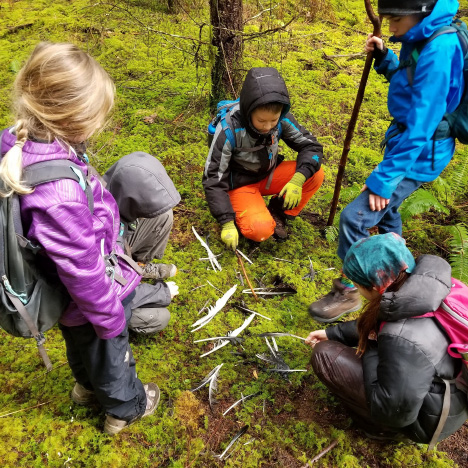
Kettle Falls Elementary fourth grade expedition: the stories tracks tell
Case Study One: Indicator Species of Bangs Mountain
Our Learn and Serve Grant gave a team of six staff members the opportunity to participate in a SEA (Service, Education and Adventure) training this fall. This adventure included learning to track with Tom Murphy of Edmonds Community College and the LEAF (Learn-n-serve Environmental Anthropology Field) school. This so engaged the teachers that we were determined to give our students the same opportunity. Murphy was able to create an alterna- tive winter course that brought 12 college students to Kettle Falls for a week. During that time, the LEAF school taught the students how to recognize tracks and gaits of our local animals. The focus was on five animals: whitetail deer, turkey, snowshoe hare, lynx and coyote. These animals were chosen with help from the Forest Service because of their status as indicator species for the Bang’s Mountain area. Students spent time in the forest that week, learning to track, photograph tracks, and measure tracks. They also learned to set trail cameras along trails in order to capture photos of the elusive animals.
Students from Kettle Falls High School Wildlife class with teacher Jono Esvelt participated in each of these activities sup porting the fourth graders throughout this expedition. They also took on the task of writing “field guides” for the fourth graders to use in their work.
This project focused on the learning targets of
- I can independently sort animals by the structures and behaviors that help them survive in their environment.
- I can independently list 4 parts of an animal and describe how the parts help the animal meet its basic needs.
- I can independently generalize from multiple forms of text to learn about forest animals.
- I can independently elaborate using details and/or examples about one forest animal.
- I can edit for capitals against the class capitalization chart.
Students learned about each animal through predicting structures and behaviors by analyzing a collage of photos and You Tube videos. Predictions were recorded before reading field guides and predictions were confirmed or not. Once the recording sheets were completed, the students wrote expository papers on the survival structures and behaviors of each animal. These were combined to create PowerPoint slides that will be included in their final product, some with actual photos of the tracks or animals that were photographed at the Bangs Mountain site. The good news was that some animals were captured by the trail cams, but some remained elusive!
Case Study Two: Food Webs of Bangs Mountain
This project really focused on the interdependences within the forest ecosystem. Learning targets in this investigation focused on giving students the knowledge to be able to complete the narrative prompt:
You are a wildlife biologist researching animals on Bangs Mountain. One of your jobs is to report to the community of Kettle Falls the stories the animal tracks of an indicator species told you while doing your fieldwork. To do this you will need to describe where the tracks were found and your inferences of what the tracks are telling you about that animal’s daily life:
- I can describe the interdependences in a forest ecosystem.
- I can explain how a forest ecosystem impacts animal population.
- I can independently generalize from multiple forms of text to learn about forest ecosystems.
- I can write a narrative with a clear beginning, two events and a clear ending.
In order to make this narrative realistic students needed to understand the actual role of a wildlife biologist. Learning about careers while in engaging expeditions opens our students’ eyes to the world of possibilities. Students continued their fieldwork, checking their trail cams, snag counts (their first monitoring experience), searching for tracks and other sign of life in their plots and were prepared for snowshoeing (though there simply wasn’t enough snow for them this year). Using the reading skill of “generalizing to understand” helped student comprehend the interdependence of the forest and was built through reading, photography, experts, media, data and many simulation games. After each activity students recorded “new learning” on anchor charts that build the content schema. They also recorded their use of the skill “generalizing” on anchor charts to show their ability to be meta-cognitive about comprehending new material. Students were able to use the information gathered from the multiple sources to write their narrative.
Case Study Three: Bangs Mountain as a Changing Ecosystem
Now that the students have developed a level of knowledge about the interdependence of forests they are ready to move on to the changing ecosystem. This is when they really become experts and begin to look at the many stakeholders of the forest. Their fieldwork becomes very data based. Through skill building in P.E. they learn about pacing. Each child is responsible for pacing off 104 feet, using a compass to keep their lines straight, they determine a half acre plot for their team. They use a tape to measure their accuracy after pacing and the corners are marked on the GPS so that their plot can be found on Google Earth. Students are now collecting data on the canopy by measuring open and covered areas. They have learned to use transect lines during their monitoring. This data is part of the baseline that will be used in the study. They identified three plants in the understory and did a plant count of their plot. Their study of the animals in their plot also continued, with data from tracks and trail cam photos. The most common track and photo taken was squirrels, though they are not one of the indicator species. Students found little evidence of the lynx at their plot. Animal population changes will be one indicator of increased health of the forest over time.
During this project students learned about many changes that can happen to forests over time. The learning targets for this project are:
- I can independently describe how onepopulation may affect other plants and/or animals in the forest ecosystem.
- I can independently evaluate one population in different forests, determine which will thrive and give clear reasons.
- I can independently describe three ways that humans can improve the health of the forest ecosystem.
- I can independently assess the author’s effectiveness for a chosen audience.
- I can independently organize my writing.
This means:
- I will write an introduction, supporting details using examples, and conclusion in an expository writing.
Each day of this project focuses on a change in the forest ecosystem. Some are changes that have taken place at the Bangs Mountain Project and some are changes that could eventually happen. All students receive the same reading each day, but they read the articles for a different purpose: natural or man-made changes, population changes, or gradual or rapid changes. Each student becomes an “expert” on their article. The students then “jigsaw” their articles once they have recorded the important information. The student experts then share out in small groups, creating a real need for students to comprehend and analyze their text. Special Education and Title I students are pre-loaded with vocabulary and content before the article increasing their ability to fully participate while in class. Once the information has been analyzed students come together to complete anchor charts where they record the changes and determine if human impact was positive or negative. They also determine the author’s purpose and if the author was successful in delivering their message.
By the end of this case study they have a thorough understanding of thinning, prescription fires, recreation management, forest flu and other healthy management issues.
We believe that reading is only one vehicle to understanding new ideas. Fieldwork, media and experts are also key components to creating powerful learning tools. Experts from the timber industry, Forest Service, Conservation NorthWest, and Department of Fish and Wildlife have all volunteered to work with our students, ensuring that students are learning realworld applications of the knowledge. Each of these experts will not only share their expertise on managing forests and their per- sonal perspectives of what makes a healthy forest, but also about their careers.
The students will complete this project with a simulation from Project Learning Tree, “The 400 Acre Wood.” Students will determine the actions taken to manage a forest much like their plots on the Bangs Mountain Project. This project has a balance of Vibrant Economy, Healthy Environment, and Equitable Society, as recommended by The Sustainable Design Project Teacher Manual. (Wheeler, Bergsman, Thumlert 2008.)
 The Final Presentation of “What is a Healthy Forest?”
The final project is a culmination of all of the data that the students have collected while completing this project. Data is compiled in a variety of ways. The ani- mal monitoring is a graph of the sightings caught on the trail cams, the plant monitor- ing is a graph as well, both done on Excel. The canopy is drafted on graph paper, indicating the cover and open space. There is also the map from Google Earth, indicating each plot for future reference and to gauge changes over time. This work is gathered in a Power Point to be presented to NEWFC at a future meeting.
Kettle Falls Elementary: expeditionary learning and 21st century intertwined
Our students had the opportunity to become engaged in their local forest, gathering a respect for the land, observing the interdependence and understanding the decisions made by others that use our forests. Students were able to meet rigorous learning targets and assessed independently on each target. They collaborated to create authentic projects that reach beyond their school walls.
The expedition included many different modes of learning during this project that are key to Heidi Hayes Jacobs’ Tenets for Purposeful Debate leading to Content Upgrades:
- • A personal and local perspective is developed and presented in the content area, where natural and viable.
- • The whole child’s academic, emotional, physical and mental development is thoughtfully considered in content choices.
- • The possibilities for future career and work options are developed with an eye to creative an imaginative directions.
- • The disciplines are viewed dynamically and rigorously as growing and integrat- ing in real-world practice.
- • Technology and media are used to expand possible sources of content so that active as well as static materials are included. (Jacobs p 31).
Through compelling expeditions students at KFES achieve many 21st century outcomes. Students build strong habits of work, through both performance (traits that enable students to perform to their potential) and personal relationships (traits that enable students to be good people and community members). They are motivated to learn. Students believe that they have the ability to meet their targets, have clear targets that they can self-assess their progress against, and are connected to their school through the work they do. We believe that academic achievement is increased when students are engaged in learning. Through authentic expeditions like “The Stories Tracks Tell” students build life and career skills. Real world problems increase students’ critical thinking and problem solving skills. The use of technology opens the classroom to wider world, with meaningful examples of the work our students are doing. Our students increase their understanding of 21st century themes such as environmental literacy. (Hulleman, Hartl & Ciani 2009). Through compelling expeditions our students are engaged, supported and held accountable to high standards.
References
Hulleman, C., Hartl, S., & Ciani, K. (2009). Character, Motivation, and Engagement in Expeditionary Learning Schools, Review of the Relevant Literature and Available Measurement Instruments. Nellie May Education Foundation. Expeditionary Learning Core Practice Benchmarks (2003). Garrison, NY: Expeditionary Learning Outward Bound.
Jacobs, H. H. (2010). Curriculum 21: Essential Education for a Changing World. Alexandria, VA: ASCD.
Wheeler, G., Bergsman, K., and Thumlert, C. (2008). Sustainable Design Project Teacher Manual. Olympia, WA: Office of the Superintendent of Public Instruction.
Greg Goodnight is superintendent at Kettle Falls School District.
Valerie McKern is principal at Kettle Falls Elementary.

by editor | Sep 17, 2025 | Data Collection, Environmental Literacy, Experiential Learning, Inquiry, Marine/Aquatic Education, STEM, Student research, Teaching Science
Making Science Engaging at Camp
Connecting art and science helps students find STEM classes more engaging and enjoyable
By Elli Korthuis
4-H is a youth development organization that focuses on helping members, ages 5-19 years, grow as individuals through their mastery of their passions, referred to as their spark. The more traditional 4-H program offers clubs in projects such as sewing, presentations, and livestock. However, 4-H reaches a broader audience through its non-traditional programs including camp and in-school instruction.
We attempt to offer a broad range of classes at our 4-H camps including those in STEM (science, technology, engineering, mathematics). One of the reoccurring themes we see in 4-H camp evaluations is that the science classes are “boring” while the craft classes have remained highly popular. With the growing need for STEM education, we needed to find a way to make these classes more engaging and enjoyable for the youth.
Over 2017, my colleague, Robin Galloway, and I developed a camp class to teach aquatic science, microscope skills, and basic nature terminology. To engage the youth in the STEM themed class, we incorporated art lessons since this was where their interest resided according to past evaluations. It was initially to be taught at the Oregon 4-H Center in Salem for campers in grades 4 – 8 along with their camp counselors. The facility is in a forested region with camp cabins, several buildings for lessons, and a pond.
During the class, we started indoors with a discussion of what organisms and materials could be found in the pond. I opened by asking which youth would want to drink the water from the pond. To my surprise, nearly half the class agreed that it would be safe to drink the unfiltered pond water. Several more said they wouldn’t because it was “gross” but didn’t have an explanation for their answer. We talked about the flora and fauna that may leave their traces in the water all the way down to potential microscopic organisms. Terms were explained along the way but there was nearly always at least one youth that could define a scientific term for the class. It was also an opportunity to gauge how in depth their knowledge was of water particles from different sources.
After our discussion, we went as a group to the pond and they could compare their discussion to what they were seeing. We got a bucket of pond water for a water sample and the youth had the chance to identify some of the particulates. Clipboards with water color paper and a pencil were given to each youth and they were asked to draw the macroscopic world they were seeing on the top half of their paper. The drawing time gave us the opportunity to delve into how some of the organisms present could affect us if we drank the water and what other organisms and materials may be present at different sources such as the ocean, a river, or a swimming pool.
The class finished their drawings and we took our supplies and the water sample inside. I put a drop of the water sample on a microscope slide, making sure to include the particulates that had filtered to the bottom of the bucket. We had brought a digital microscope that included a small LCD screen to view the slide. In a larger group setting, this microscope could have been attached to a projector to show a greater audience. With our water sample under the microscope lens, we identified the materials and organisms. One of the highlights was when we found a mosquito larva and were able to use the highest magnification to view the blood platelets flowing through its open circulatory system. It wasn’t an original part of the lesson but an added bonus. Although some youth were disgusted by what they saw, the majority were fascinated and wanted to continue in the discoveries. The class was then asked to draw the microscopic organisms and particulates they had seen on the bottom half of their paper. We wanted to encourage the scientific fascination so after a quick explanation of how to use a microscope, the youth were free to continue searching for other organisms if they wished to during the allotted drawing time. We also discussed how some of the organisms they had seen impact our health and environment.
Although many of the youth were comfortable drawing what they saw, there were a few in each class that didn’t feel confident in their drawing skills. We encouraged them in different ways including saying perfection was not the goal and joking that it could be called abstract instead. The time constraint also helped encourage the youth that weren’t as confident drawing because they understood high quality drawings could not be expected in the given time.
 Water color pencils were distributed after the initial drawings were done so the campers could fill in the color. While they were coloring, I poured our water sample into several cups and passed them around with paint brushes. The youth then created the water color painting by brushing the water sample over the water color pencil areas. While painting, they remarked on how the particulates from the pond water changed both the texture and color of their painting. We talked about how the results would be different if they had used another water source and they were overflowing with ideas.
Their views on whether they were willing to drink the pond water were drastically different from when we started the class. Not one camper wanted to drink the water and many were quick to offer their explanations why.
We ended with a quick evaluation to gauge how their opinions about both art and science had changed after taking the class. Some of the highlights from the evaluation include:
- • 71.11% agreed or strongly agreed science is not boring after taking this class.
- • 76.09% agreed or strongly agreed they want to learn more about science as a result of this class.
- • 63.64% agreed or strongly agreed they would do more art in their free time because of this class.
The evaluation method was also an experiment for our program. We were trying to encourage higher levels of participation since regular paper survey evaluations are turned down by a large percentage of attendees normally. Instead, we had larger flip chart papers with each evaluation question stuck to the wall with columns for strongly agree, agree, disagree, and strongly disagree. Each youth was given a set of numbered stickers to share their opinion. This made the evaluation more engaging while remaining anonymous and encouraged more honest opinions. It was an extremely successful evaluation method that I will continue to use in the future.
After successfully conducting the class with 4th to 8th grade youth, we decided to offer it at a day camp for youth ages 5-8. The concepts were simplified but the class was still a high level science lesson for youth in this age group. They still discussed what the water sample contained, defined terms such as microscopic and macroscopic, learned how to use a microscope, and exceeded our expectations for their ages. These youth were not formally evaluated but from my individual conversations and the group discussions, I observed that the youth were engaged and excited about the entire class.
Since conducting the classes, this concept has been taught at the American Camp Association (ACA) 2017 Oregon Trail Fall Education Event where camp staff and directors from Washington, Oregon, and Idaho all enthusiastically agreed that they would like to incorporate it in their own classes. It will also be taught at the Western Regional Leaders Forum held in San Diego, CA in March 2018.
I am excited to expand this lesson into several 4-H camp STEM classes in the future. I believe that bridging the gap between art and STEM has proven itself to be a sound method for teaching “boring” science concepts to campers in an innovative and engaging way.
 Elli Korthius is a 4-H Youth Development Educator for Benton County, Oregon.
by editor | Sep 15, 2025 | Adventure Learning, Conservation & Sustainability, Critical Thinking, Data Collection, Environmental Literacy, Experiential Learning, Forest Education, Homeschool, Inquiry, Outdoor education and Outdoor School, Place-based Education, Questioning strategies, STEM, Teaching Science
A Natural Fit: Homeschooling and the Establishment of a Research Forest
by Jess Lambright
For those open to an alternative educational path, a classroom with no walls or desks but instead trees, meadows, and streams, offers abundant opportunities for scientific exploration. My journey in outdoor education started by home-educating my own children, but soon expanded to include other students and families. Although making everyday a field day comes with certain challenges—such as very wet, cold winter days—it has also shown me how adaptable young people are, and how many spontaneous and fascinating learning opportunities present themselves when you commit to regular immersion in the natural world.
I have come to appreciate the vast range of possibilities in which students can acquire knowledge. While some homeschooling families follow packaged curriculum closely and monitor carefully to make sure their children meet state standards each year, others chose a less structured approach called unschooling, rooted in a deep trust for kids’ natural tendency and ability to learn. This philosophy can free a motivated young person to dive deeply into an ocean of learning powered by autonomy, inspiration, and infinite possibilities.
Connecting to place and stewardship of land
A multi-disciplinary unit study called My Tree and Me, where each student was connected with a specific tree which they measured (diameter, height, age) conducted secondary research about the species, wrote poetry, and created art with materials from the tree. One student decided to give his final poster presentation from the branches of the Cascara tree he had spent so many hours with.
The first outdoor program I hosted involved an established group of kids spending an entire day outdoors, once per week, for over four years. Week after week and year after year we returned to the same 40-acre woods from the first days of fall through the start of summer. It was common for our group to wander through the forest, without a destination or agenda, letting our innate curiosity lead the way. Wandering freely, with open eyes, allowed us to get in touch with what excited us and created opportunities for true discovery (Young et al., 2010, 56).
It filled me with satisfaction to watch the deep connection to place that developed over time in each of us. Monuments and landmarks, like a circle of giant old moss-covered stumps towards the southwest corner of the forest, acquired names and memories and provided comfort and familiarity when they were encountered. We would experience the wet meadow as a place that requires rubber boots to traverse in the wet months, a beautiful explosion of white flowers and soft grasses that dance in the wind in the summer, and a sea of delicate purple camas flowers in the spring. One year we returned to the same sit spots week after week, recording changes in our journals as spring brought all the growing things to life.
Students pause to examine a pile of feathers they discovered while exploring the woods on a rainy day. The group came up with a series of questions about what happened and brainstormed ideas about how they could investigate further to potentially find answers.
Spending time on a particular piece of land, through the seasons and years, inevitably leads to a sense of kinship and creates an urge to protect and enhance the natural environment. It’s been rewarding to teach students about which plants are non-native and potentially harmful to the local ecosystem, then see them step up as guardians of the land. When we wander through the woods, sometimes they spot a pocket of invasives and if we’re lucky enough to be carrying long-handled loppers, the team of weed warriors can quickly level a patch of Himalayan blackberry. In addition to studying and exploring, offering students an opportunity to actively participate in land management elevates their sense of purpose and deepens their connection to the natural world.
Full Family Learning
Homeschooling naturally leads to multiple ages and families all learning together. In the early days of our homeschool outdoor program the adults often observed activities and supported logistics. But over time it became clear that we truly were a mixed-age group of learners and explorers. Treating everyone as learners equally can have the effect of empowering young people. Sometimes kids master skills quickly. teaching what they’ve learned to adults. And sometimes the best exchange comes not from experts, who have a deep and longstanding understanding of a concept- but those who have recently experienced the gift of insight.
Mixed age learning is a mutually beneficial relationship fostering growth in multiple ways. Adults sometimes shelter in the security of topics they already understand and avoid venturing into areas less familiar. Conducting scientific inquiry in nature is ideal for having a high ceiling and a low floor: everyone knows something, and no one knows everything! Cultivating a growth mindset, by creating an atmosphere where mistakes are celebrated as learning opportunities, and where having a question is as valuable as having an answer (Boaler, 2015, 11), pairs beautifully with immersive study in nature.
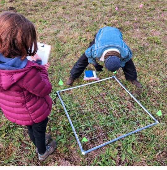
A team of researchers determine the percent meadow knapweed present in a one-meter plot square by examining each of 100 smaller squares for the plant of interest.
Authentic Curriculum
Each day that I meet a group of students in the natural world, I come prepared with a plan for that day. Sometimes my plans are elaborate and detailed, and sometimes they are less specific and open to input from my fellow adventurers. But without exception I am mentally prepared and openly delighted to be upstaged by the unexpected. Whether it is locating a dead porcupine after noticing an unusual smell, being suddenly pelted by large hail, being startled by the arrival of the cacophonous noise of a murder of crows, or being circled by two deer so distracted in their mating dance that they fail to notice us; being fully present for nature’s dramas is my top priority.
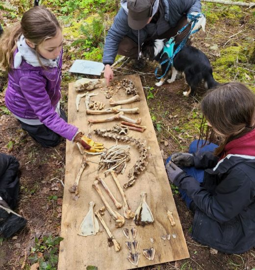
After waiting over a year for the soft tissue to decompose, students collect and sort bones from a deer that died of natural causes near the Bear Creek Wilderness.
One day, just as the families were arriving at the Bear Creek Wilderness, a truck with two wildlife professionals pulled up to examine a deer laying in the horse pasture adjacent to our meadow. Curious, we gathered to ask questions about what might have happened. When they offered to let us keep the recently deceased animal, we gladly accepted- and spent the day dragging it across the meadow into the woods, securing it with paracord, and setting up our two trail cameras to watch what would happen.
Each week we checked on the deer, and everyone brave enough to venture near got to experience first-hand what decomposition looks and smells like. The camera footage revealed a series of fascinating dramas involving a bobcat, opossums, neighborhood dogs, and finally turkey vultures. A year and half later we carefully collected the bones and spent hours sorting and reconstructing a full deer skeleton. Finally, we tried our hands at making bone tools. In my experience, the best learning opportunities are not planned or expected. But when we build regular rhythms and practices, it is possible to “lay the groundwork for the outbreak of authentic curriculum” (Sobel, 2008, 81).
Cultivating scientific inquiry

Students work to match specific leaves to nature journal pages. Each student found a leaf while wandering through the woods, then recorded details of that leaf in their nature journals using words, pictures and numbers. The leaves were collected, then each student selected a new leaf and found the corresponding journal page.
Getting to know a place, including its seasonal changes, provides a useful perspective when it comes to asking research questions. An invaluable tool to record and remember discoveries, questions and observations is the field notebook, or nature journal. Developing the habit of collecting data with pencil and paper while exploring the natural world takes ongoing dedication, is deeply personal, and will certainly evolve through the years if one continues the practice (Canfield, 2011, 187-200). Nature journaling techniques that involve close examination of specimens in order to draw them, often reveal details that would have been overlooked with a quick glace or photograph. Indeed, to truly get to know a specific plant species it is hard to imagine an activity more educational than carefully drawing each of its parts.
Foundational to scientific inquiry is the research question, or asking questions within the realm of science. There are plenty of valid and interesting questions that one might ask while pondering the wonders of nature, and it’s important not to shut down inquiry when a question like, “Does it make this tree happy when I climb it?” arise. If limited to knowledge bound by science, one may miss rich worlds of philosophy, spirituality, intuition, and other ways of knowing. Still, once we are ready plot our scientific course it’s useful to remind students that questions should be measurable (Laws & Lygren, 2020, 90-93).

At the start of a student-led wildlife study, one researcher, who had taken time to carefully read the manual and test out the equipment, teaches the other students how to label their memory cards and set up their trail cameras. This project was made possible by a generous grant from the Diack Ecology Education Program.
Research Methods
When guiding young people into the world of field research it is helpful to start with basic techniques and big picture, cross-cutting concepts. Keeping track of important details in a field notebook and not forgetting to record obvious but key information like the date and location takes practice before it becomes routine. Collecting data can be time consuming, but sometimes trying to interpret sloppily recorded field notes can lead to tedious and frustrating hours at home. Finding a doable and interesting research question, taking into account confounding factors, and dealing with the disappointment if all the hard work to apply different treatments on an invasive plant all result in similar outcomes, requires a certain level of maturity and commitment.
Digging into a full-fledged research project requires determination, perseverance, and time, but it is possible to introduce students to the exciting and fun parts without getting bogged down by details. I recently taught a research methods class to elementary and middle school students with the goal of having hands-on experience with sophisticated research equipment without requiring data analysis or report writing.
We practiced collecting samples, and at first, we recorded in our field notebooks all the important metadata. Inspired by collection and observation, but limited in time, we then simplified the process to maintain interest and focus. For the rest of our forest walk we collected whatever samples caught our eyes- and mentioned what we would record if we were doing a research project- but kept it fun and quick so we still had time to investigate them at the end with magnification. Keeping data collection fun and exciting for younger students makes for a useful introduction to scientific inquiry and sets them up for conducting their own research in the future.
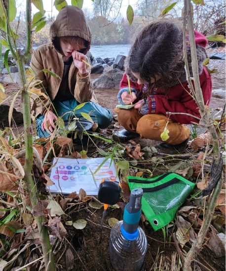
Students collect carbon dioxide and pH data from a patch of earth using equipment funded by the Diack Ecology Education Program during a research methods class with Wild Alive Outside.
Student-Led Research
In my experience, homeschoolers have a low tolerance for contrived activities, busywork and doing things for a grade. Any activity, assignment or project needs to be authentically meaningful. While it may be hard to force them to fill out a worksheet recording what we just discussed, they often thrive with open-ended activities and projects they can direct. It’s important to provide the appropriate scaffolding, and offer examples, but I have been impressed by how quickly and enthusiastically students construct their own research projects. As a mentor, I sometimes struggle with finding balance between requiring them to do something ‘right’ and encouraging critical thinking along with a safe place to fail, each of which are valuable learning experiences. Allowing students to take ownership in the learning process enhances the development of scientific thinking.
Once, a student created an elaborate plan to attract birds for his trail camera research project involving dead trees, peanut butter, and bird seed. There was tangible disappointment when the resulting images revealed many more rodents than birds, but it led to a new series of questions as well as an understanding about wildlife activity in that area. Field science is almost always iterative in nature, with new questions emerging from initial data and, ideally, the opportunity to inquire further and collect more data. With guidance and partnership students integrate information while maintaining natural curiosity.
Expanded Educational Support
Last year our outdoor program, Wild Alive Outside, received its first infusion of grant-funded scientific equipment. The Diack Ecology Education Program financed a set a trail cameras for our students to study wildlife activity at the Bear Creek Wilderness. Access to high-quality equipment has been a game changer for our little research group. Students felt empowered to design their own experiments by having full control over one of the trail cameras and two high-capacity memory cards. In addition to learning what wildlife passed through the area of the forest or meadow they selected, they gained experience with organizing and analyzing digital data. For some, it was their first exposure to spreadsheets, and others had to push their edges to patiently examine each of hundreds of photos. After months of data collection and conducting secondary research on one of the many wildlife species they discovered, they created posters to present their findings.
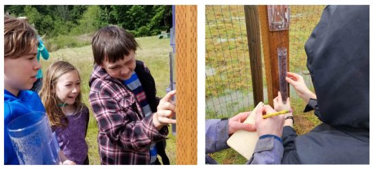
Students carefully measure the water in the rain gauge to determine rainfall over the previous week. Data is later reported to the CoCoRaHS website as part of a nationwide citizen science initiative.
For several years now, each day on the land begins with checking the rain gauge. Because we only visit once per week, we often have several inches of rain to carefully measure and record in the notebook. This simple ritual wakes up scientific thinking: “remember to look straight on before taking a reading,” connects us to what’s been happening while we were away: “no wonder there’s standing water in the meadow,” and gives us access to site-specific long-term data. At the end of the water year, shortly after the start of autumn, we can look back at the data we’ve collected, compare it to previous years, and make predictions for when the rains might come that fall. Additionally, we report our data through a sophisticated citizen science program called CoCoRaHS – Community Collaborative Rain, Hail & Snow Network with thousands of other citizen scientists across the country. I have found students take data collection quite seriously when they know they are part of a larger community of scientists, all doing their best to produce accurate results.
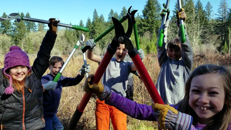
After tackling a large patch of invasive blackberry bushes, the Weed Warriors celebrate their contribution to protecting the wet meadow in the Bear Creek Wilderness.
The Bear Creek Wilderness and Student Research Forest
My program design is to plant the seeds for creating a student research forest where young people will have ongoing opportunities to learn scientific methods of field research and contribute to an ever-increasing body of knowledge through their own efforts. Just as the H.J. Andrews Experimental Forest welcomes graduate students and long-term ecological researchers and has amassed a wealth of knowledge and data about that site, we aim to support young emerging scientists with open minds and creative ideas to connect with place, nature, and make meaningful contributions to science within a community of knowledge seekers. Participants gain foundational skills together as they engage with the land, utilize scientific tools, grow as learners, and share knowledge with each other.
References
Boaler, J. (2015). Mathematical Mindsets: Unleashing Students’ Potential Through Creative Math, Inspiring Messages and Innovative Teaching. Wiley.
Canfield, M. R. (Ed.). (2011). Field Notes on Science and Nature. Harvard University Press.
CoCoRaHS – Community Collaborative Rain, Hail & Snow Network. Retrieved January 18, 2024, from https://www.cocorahs.org/
Diack Ecology Retrieved January 26, 2024, from https://www.diackecology.org/
H.J. Andrews Experimental Forest. Retrieved January 26, 2024, from https://andrewsforest.oregonstate.edu/
Laws, J. M., & Lygren, E. (2020). How to Teach Nature Journaling: Curiosity, Wonder, Attention. Heyday.
Sobel, D. (2008). Childhood and Nature: Design Principles for Educators. Stenhouse Publishers.

In 2019, Jess Lambright started a nature school for homeschool families where once per week kids and parents spend all day outside learning wilderness skills, exploring, developing naturalist knowledge, conducting field studies, and connecting with nature, themselves, and each other. She founded Wild Alive Outside in the summer of 2023 with the goal of getting more youth outdoors to discover wonder and inspiration in the natural world through science, outdoor skills, and wilderness connection.


