by editor | Aug 27, 2017 | Outstanding Programs in EE
A Biome Bonanza!
After taking a class for teachers about sustainability several years ago, my teaching partner and I were inspired to get kids out and about and connected to the natural world more. We looked at our science curriculum and with the help of Bob Carlson and his staff at our district’s CREST Center, we developed a couple of great overnight experiences for our students.
By Lisa Terrall, Bolton Elementary School
West Linn, Oregon
 iving in Oregon, we have easy access to many different biomes in which living things have adapted differently to their environments and lots of locations where evidence of volcanic activity is visible. In 4th grade, we did a lot of work around plant and animal adaptations, as well as geological changes to the Earth. We developed a 4 day “Biome Bonanza,” during which we spent a day at the coast, a day in an Oak Savannah and two days in the Columbia River Gorge.
Our day at the beach is a day trip. We stop at a spot in the coast range mountains where we can find sea floor fossils at a fairly high elevation. This allows kid to begin to see evidence of plate tectonics and how the crust that used to be the sea floor was lifted and is now part of a mountain. They love discovering and trying to identify the fossils they find and are amazed at how dynamic the Earth is.

 Our next stop is at the coast. We spend quite a bit of time exploring local tide pools and finding creatures that live there. Students get to see species they have researched up close and are able to begin to identify the structures and functions of their bodies and how they help with survival in that particular environment. Tide pools are great because they have multiple zones within them and the adaptations are different from zone to zone, as well as from tide pools to other surrounding environments like the ocean or the coastal forests. After our time in the tide pools we take a short forest hike, looking for how the environment is different, as well as how species have adapted for survival. We also get a good look at some of Oregon’s rocky cliffs and are able to see evidence of past basalt flows.
Our next day is spent in our town of West Linn, at a local Nature Conservancy preserve called Camassia. It is walking distance from our school and we are able to see more evidence of basalt flows, as the entire preserve is on top of columnar basalt with much of it exposed. The soil here is very thin and students are able to see how plants have adapted to this condition. They love being able to compare this to the coastal forest they were in just the day before. They are always amazed that the same basalt flow they are standing on stretches all the way to the coast and is contained in the cliffs they were able to see the prior day. It begins to give them a sense of connectivity and the magnitude of the volcanic events of the past. While we are there, we take the temperature of a pond and get a water sample to test for pH and turbidity when we return to school. Testing the water sample gives our students time to practice using the testing equipment and to recall 3rd grade learning around salmon and what they need (as far as water conditions) to survive.
 The next two days of our outdoor experience is spent on the road in the Columbia River Gorge. We take our 4th graders on an overnight trip to see more evidence of the basalt flows, learn about the Missoula Floods that shaped the gorge and our local valley, and to do more comparison of the plant and animal adaptations in yet a different environment. We spend time at a wildflower preserve, taking in the panoramic views of the gorge and identifying/sketching wildflowers. Students love identifying the flowers with a plant identification book and trying to figure out their adaptations. This area is quite windy and exposed to the weather being high up at the top of the gorge, so students get to see waxy leaf coatings, things growing low to the ground and even some hairy leaves. They compare that to the large, flat, shiny leaves they had seen in days prior in the coastal forest.
We also go to a local museum to hear and see a program about the Missoula Floods. This allows students to get more information from an expert about how the gorge they have just viewed came to be. We spend time at the museum exploring the Ice Age exhibit and taking a guided walk around the grounds to hear more about and see native flora and fauna.
That night we go to pizza and swim at a local pool before crashing on the floor of a grade school.
 The next day we spend time at Hood River Middle School hearing from Michael Becker and his science students about how they are continuing to strive to create a more sustainable space for learning. They have an amazing greenhouse that is ever evolving to include new and innovative things. The middle school students give our 4th graders a tour of the area, including a discussion about the geothermal energy system under the soccer field. This is a very inspiring part of the trip and spurs our students on to thinking about ways we can improve what we do at our own school.
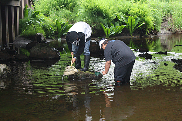
When we leave the middle school, we head to a local falls area and go on a great hike. Students see and point out evidence of basalt flows, erosion, plant and animal adaptations and enjoy the outdoors. We also find a spot to pull out water testing equipment and run stations for students to test pH, temperature, and turbidity, as well as to collect and identify macroinvertebrate samples. This is always a highlight of the trip! At the end of our water stations, students make a determination about whether or not this stream is a healthy one for fish using their data as evidence.
Our trip is capped off by a visit to Bonneville Dam to see the fish ladders and learn how electricity of created from water flow.
 Overall, we have a great trip and students gain so much! They are able to see and touch things that they have studied in science class. They make connections, ask lots of great questions and enjoy the beauty of our natural spaces. We hear back from many students and parents that they re-visit many of the locations as a family at a later time and that the students are great tour guides with lots of information to share.
As curriculum and teaching assignments have changed, we have tweaked this trip for 5th grade. We are able to review past learning about salmon, plant and animal adaptations, and geology, as well as focus on new learning about energy. This year it is a two-night, three-day trip that will include many of the above activities, but will also include a day that has a visit to the Biglow Wind Farm in Wasco to see windmills in action, and a visit to White River Falls State Park to see a now defunct powerhouse at the base of a falls. We will also spend time at a local business in Hood River learning about their commitment to renewable energy and seeing their solar roof. Our students have been researching renewable energy in class and this will give them opportunities to enjoy the great outdoors while seeing things they have previously read about.
We feel these experiences are important for students now more than ever. In an increasingly digital world, it could be easy for students to be indoors more and pay less attention to the natural world around them. In addition to making the classroom learning feel more real, these trips get kids out, get them active, and help them connect to the wonder and beauty of our natural world.
by editor | Dec 15, 2015 | Place-based Education
Engaging Students With/in Place through Community Mapping
By Susan Jagger
University of Toronto
This article was reprinted from Pathways – The Ontario Journal of Outdoor Education, Volume 26, Issue 3
 ommunity mapping brings together local people as they celebrate local geography, ecosystems, and stories of place through created representations of their communities (Lydon, 2003; Perkins, 2007). Mapmaking itself is a way of making sense of the world and of our place within it, and community mapping can help us to come to know our local environments. The process of mapmaking is key in community mapping; indeed, much of the value in community mapping is not so much in the product but rather in the collaborative sharing and discovering of place that leads to the map’s creation (Parker, 2006). I wondered about the pedagogical possibilities for community mapping in the K–12 curriculum and began a study that examined how participation in such a project could influence grade four students’ environmental knowledge, attitudes and actions (see Jagger, 2009 and Jagger, 2014 for a discussion of the research).
I worked collaboratively with Ms C.1, a grade four teacher, to plan and teach a three-month long, cross-curricular community mapping project of Sandy Beach Provincial Park. We focused on four themes in our project: local history, natural history, First Nations history, and personal connections to the park. Our mapwork drew from multiple field trips to the park, a visit to the local cemetery, and class visits from the museum manager and school First Nations liaison person. The following is an overview of some of our project’s mapping activities.
Introducing Mapmaking and Sandy Beach
We began our project with a small group brainstorming web of the question, “What can maps tell us?” To extend thinking, we shared a range of maps—from traditional topographic maps to handmade written and photographic representations of place—and asked students to then revisit their webs to make additions. The students were drawn to familiar political and road maps; some students did not identify the alternative maps as maps at all. One student, Charles, confided in me that maps were not made by people and that “you can’t make maps.”
Following this initial look at maps, we had our first visit to Sandy Beach. This visit was intended as an opportunity for students to familiarize themselves with the park and, given that it was the beginning of September, a chance for the class to build a sense of community. Students used digital cameras to take photographs and several parent volunteers accompanied us, allowing for small group, free-choice park explorations.
Back at school, students made their first maps of places very familiar to them—their bedrooms and the school playground. Bedroom maps were done by students at home and in a form of their choice. Most students created bird’s eye view maps of their rooms; some made their drawings to scale and in perspective. In small groups, students created a section map of the school playground (the playground was divided into nine sections to be mapped in a three-by-three grid; when completed the maps were put together to create a complete playground map). To guide their mapwork, students were asked to explore the sounds, textures, colours, shapes and sizes in the playground, and they spent time outside listening, touching and seeing the complexity of the playground space. The completed maps took on a variety of forms (e.g., side view, bird’s eye view) and included a range of techniques (e.g., grass pieces glued onto map, crayon rubbings to show texture).
Connecting with Local and First Nations Histories
Ms C. and I wanted to actively bring the community—its people and places—into our mapping project. To do this, we complemented our experiences at Sandy Beach with visits from both the local museum manager (Mr. B.) and the school district First Nations liaison person (Ms E.), and with a class field trip to the local cemetery.
Mr. B. arrived from the museum with (quite literally) a treasure chest full of artifacts from Sandy Beach to share with the students. Some pieces were the very tools used by the Barry family—the family who used to live and farm on the land that would become the park. The students quickly made connections between what they discovered at the park and the stories told by Mr. B. Guided by careful observations, the students made pastel sketches of chosen artefacts.
As it was important to us to recognize the traditional uses of the land in our mapping work, we invited the school district’s First Nations liaison person, Ms E., to be part of our project. Ms E. visited the class twice, and during her visits she taught the students about the traditional uses of Western Red Cedar in both practice and ceremony. In her workshops, Ms E. showed examples of woven cedar baskets and jewellery, and taught students to weave cedar mats of their own. Her underlying message to the students about cedar, and all natural elements used by First Nations people, was of respect and the importance of giving back to the land when we take from it.
The local cemetery was a short walk from the school and afforded us with a further trip back into local history. Here, the stories of the Barry family came to life as many of the family members were buried there. The students searched the cemetery for all of the members of the Barry family and used crayons and paper to make tombstone rubbings.
Exploring the Natural History of Sandy Beach
We took our second trip to the park about one month into the project. This visit was an exploration of the natural history of the park including the diversity of life and the park’s ecosystems. To guide their experiences, we asked students to keep three words in mind: unusual, interesting and change. Again, students used digital cameras to capture their explorations and parent volunteers accompanied small groups in three activities: a low tide beach walk, a scavenger hunt, and a sound and colour walk.
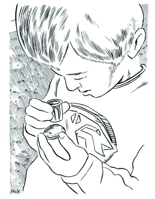
Ms C. led the students on the low tide beach walk. We planned our visit to coincide with low tide so the students could compare and contrast the high and low tidal zones and the transition between zones. Ms C.’s experience as a park naturalist at Sandy Beach guided the students’ explorations as she helped students to identify species, ecosystems and interactions. Students also used small magnifying glasses to examine details and intricacies of the features of the beach. Below, Quinn uses a magnifying glass to examine tiny molluscs attached to a rock (see Figure 1).
I created a map for a parent-led scavenger hunt that guided groups along a planned route through several different ecosystems—meadow, marsh, forest and beach. Students were asked to be mindful of their changing surroundings and reminded of the trip’s guiding words. Student observations were documented in their photographs and field notes. These photographs were put together in a class album of the visit, and back at school the groups came together again to write descriptive captions of the pictures from their walks.
To increase students’ awareness of the living things around them, I led groups on a sound and colour walk during which participants were asked to slow down and stop to listen and look. We listened quietly to the sounds surrounding us: the chirping of crickets, the laughing of ravens, the crashing of waves, the crunching of gravel. Before the start of the project, I collected paint chip cards from the local home improvement store and on our walk, we matched the cards to colours noticed along our walk. We renamed those colour samples to reflect the shades and hues of Sandy Beach (e.g., Douglas Fir Cone Brown, Rosebud Red, Arbutus Peeling Bark). The renamed paint chips were included in the class album of trips to Sandy Beach and in a mosaic frame for our emergent bulletin board map. The photographs, stories and observations from our visits to Sandy Beach were used to create an emergent bulletin board map (Sobel, 1998). I started the map with a very basic outline of the park—the shoreline, access road, parking areas and campground—and over several days, small groups of students added to the map. Some students drew in trails we walked along.
Others contributed written descriptions of features of the park they remembered. Still others added photographs that shared what we had experienced at the park. As we created the map, students looked through the album of photographs taken on our visits, shared their experiences with me, and added captions to the pictures.
Celebrating Personal Connections to Place
It was very clear to Ms C. and me that the students had developed deep personal connections to Sandy Beach. Students eagerly shared with us stories of special times at the park—recollections of weddings, first visits to the beach, earlier field trips and explorations with family and friends. It was important to us to really honour these affective understandings of place and so we focused our last visit to Sandy Beach on students’ cherished places there. As with other visits, students were in small groups, but on this visit students led the exploration of the park. The groups visited students’ cherished places and were told by the students what made that place so special to them. Many of these places were related to play—the driftwood pile that made a great fort, the tree that was like a swing, the tidal pools that were fun to explore. Students’ special places also
included spaces for quiet reflection and enjoying the beauty of the park—“the Dinosaur tree in the very quiet woods,” the beach with its beautiful shells, the amphitheatre “because I feel free there.” Students mapped their cherished places by creating clay sculptures and writing short descriptions of those places.
Mapping It All Together
Students shared their cherished places, along with their knowledge of the park’s natural, First Nations, and local histories in their If you came to Sandy Beach, I would show you… class book. We used Sheryl McFarlane’s Jessie’s Islandas a model for this mapwork, a book in which McFarlane shares the story of Jessie who writes a letter to her cousin describing all of the wonders he would see if he visited her home. With Jessie’s Islandas a guide, the students wrote letters to family members and friends who had never been to Sandy Beach. Letters included descriptions of plants, animals and ecosystems that could be seen at the park. Students recalled the stories of the Barry family’s first years on the farm and wrote about how First Nations peoples traditionally lived on the land. The letters also shared students’ own memories of cherished places and experiences at Sandy Beach. Over the course of the project, teachers and parents shared with me special memories that they had of Sandy Beach so we invited the school community to write letters as well.
Our class book beautifully brought together all of the experiences of the mapping project and allowed students (and some teachers and parents) to reflect on the experience of being and learning in place. Other books that celebrate place and could be used in mapping projects include Harrington and Stevenson’s (2005) Islands in the Salish Sea, Kronick’s (2013) How Victoria Has Changed, and Moak’s (1984) A Big City Alphabet.
Community Mapping as a Pedagogical Tool
Community mapping can be a wonderful way to infuse place-based environmental education across the curriculum. Our project was truly cross-curricular as we drew science, social studies, language arts, fine arts and citizenship together in our studies. This type of project can be easily adapted to the exploration of any local environment; the possibilities are endless. Mapping a local natural space helped the students to realize and respect the biological wealth and diversity that lived quite literally in their own backyards. Stephen Jay Gould wrote, “we cannot win this battle to save species and environments without forging an emotional bond between ourselves and nature as well—for we will not fight to save what we do not love” (as cited in Orr 2004, p. 43). Community mapping projects can help foster this critical bonding in students.
Acknowledgement
This project was partially funded by the Natural Science and Engineering Research Council, Canada’s Pacific CRYSTAL (Centres for Research into Youth, Science Teaching and Learning) for Scientific and Technological Literacy.
Notes
1 To protect the identity of participants, the names of all people and places have been changed.
References
Harrington, S., & Stevenson, J. (Eds.). (2005). Islands in the Salish sea. Surrey, BC: Touchwood Editions.
Jagger, S. (2009).The influence of participation in a community mapping project on students’ environmental worldviews. Retrieved from http://dspace.library.uvic.ca:8080/bitstream/handle/1828/2816/Final%20Final%20Draft.pdf?sequence=1
Jagger, S. (2014). “This is more like home:” Knowing nature through community mapping. Canadian Journal of Environmental Education, 18.
Kronick, I. (2013). How Victoria has changedRaleigh, NC: Lulu Publications.
Lydon, M. (2003). Community mapping: The recovery (and discovery) of our common ground. Geomatica, 57(2), 131–143.
McFarlane, S. (1992). Jessie’s island. Victoria, BC: Orca Book Publishers.
Moak, A. (1984). A big city alphabet. Toronto, ON: Tundra Books.
Orr, D. (2004). Earth in mind
(10th anniversary ed.). Washington, DC: Island Press.
Parker, B. (2006). Constructing community through maps? Power and praxis in community mapping. The Professional Geographer, 58(4), 470–484.
Perkins, C. (2007). Community mapping. The Cartographic Journal, 44(2), 127–137.
Sobel, D. (1998). Mapmaking with children: Sense of place education for the elementary years. Portsmouth, NH: Heinemann.
Correspondence concerning this article should be addressed to Susan Jagger, Department of Curriculum, Teaching, and Learning, OISE/University of Toronto; s.jagger@mail.utoronto.ca.

by editor | Oct 25, 2015 | Forest Education
Environmental Leadership: Making Connections
Two service-learning programs within the Environmental Leadership Program at the University of Oregon aim to deepen students’ knowledge of their bioregion through day-long, hands-on field trips.
By Kathryn A. Lynch, Environmental Leadership Program, University of Oregon
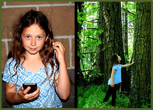
hildren and young adults are often more tuned into the screens in front of them than the landscape surrounding them; when asked which direction is north their inclination is to check their smartphones. In response, the Environmental Leadership Program at the University of Oregon is developing environmental education projects seeking to reconnect children to nature.
The Environmental Leadership Program (ELP) is an interdisciplinary service-learning program housed in the University of Oregon’s Environmental Studies Program. Our mission is to provide undergraduates with an integrative capstone experience, our graduate students with project management experience, while engaging with the community to address real needs.
Since 2001, ELP has developed and implemented 81 projects addressing a wide array of topics. Currently, our projects fall within four primary tracks: environmental education, conservation science, sustainable practices, and community engagement.
The two main goals of our environmental education teams are to: 1) provide UO students the knowledge, skills and confidence to develop and implement place-based, experiential programs; and 2) develop age-appropriate, engaging curricula for local youth, grades K-8, that promotes the stewardship of our natural world.
During winter and spring of 2015, our two environmental education teams focused on the theme of “connections.” The new Restoring Connections team worked in partnership with Mt. Pisgah Arboretum and Adams Elementary to develop and implement a place-based curriculum which included an interactive classroom lesson and a field trip to Mt. Pisgah. The team provided over 200 K-2 students an opportunity to develop a deeper understanding of where they live and the importance of conservation and stewardship. The Canopy Connections team worked in partnership with the HJA Experimental Forest and the Pacific Tree Climbing Institute to develop and facilitate an interactive pre-trip lesson and field trip for over 200 middle-schoolers. Students studied forest succession, learned how to use a compass, wrote poetry in field notebooks, and climbed 90 feet into the canopy.
To prepare for their service projects,the undergraduates first enrolled in Environmental Education in Theory & Practice. In this class, they gained a working knowledge of best practices in EE through readings, guest lectures, field trips, and most importantly, their service-learning project in which they developed educational materials for their community partners. While the specifics of the curricula were left up to the teams to determine, all teams were required to: 1) incorporate an interdisciplinary approach, 2) include multicultural perspectives, 3) use experiential, inquiry-based methods, 4) promote civic engagement, and 5) articulate assessment strategies. Their materials were pilot-tested at the end of winter term, and the teams then worked with their community partners to implement their EE programs throughout spring term. Each UO student completed approximately 120 hours of service, which entailed facilitating classroom visits, field trips, and developing supplemental educational materials (e.g. websites, presentations). What follows are descriptions of these projects, written by the team members themselves.
 Case Study 1 –
Restoring Connections: Unplugging and Reconnecting
By Ashley Adelman, Roslyn Braun, Lucas Holladay, Kiki Kruse, Kerry Sheehan, Zoie Wesenberg, and Alicia Kristen (Project Manager).
 s a group of students made their way into the Douglas-fir forest from the oak savanna, a facilitator hushed the group with a “quiet coyote” hand signal. Immediately, everyone hunkered down, peering through the brush as the group tried to get a glimpse of the discovery. A student squealed in delight. The deer was still, its gaze locked onto ours. Having taught our students about the importance of deer ears for hearing predators, they noticed how the deer kept her ears pricked forward, waiting for our next move. The group slowly moved up the hill trying to get a better view. Experiences like this have the ability to enhance the senses like no video game or television show can. Learning about environmental issues at a young age can be overwhelming, but connecting to local nature, students can become more aware of and in tune with the natural world.
In spring 2015, the Environmental Leadership Program launched the Restoring Connections project at Adams Elementary School. Our team of six undergraduates, with the guidance of our graduate project manager, was responsible for the design, creation and implementation of this environmental education curriculum, focusing on Mt. Pisgah Arboretum’s natural ecosystems.
In this pilot year, we focused on kindergarten, first-, and second-grade students. Our goal was to address what Richard Louv calls ‘nature-deficit disorder’ through the creation and implementation of a place-based and experiential educational program. According to Louv, the cultural shift in which many youth now prefer to stay inside interfacing with screens, rather than going outside to play and explore, has resulted in devastating effects on their personal well-being – physically, mentally, and emotionally – in addition to having disastrous repercussions for the environment. How we set about addressing nature-deficit disorder was informed by Howard Gardner’s theory of multiple intelligences and David Sobel’s work, which outlines a framework for age-appropriate content. Working from this theoretical foundation, we knew we wanted to allow students to explore nature first-hand to help them develop a connection to where they lived, and nurture empathy for the plants and animals that share our bioregion. In addition, the structure of our program was influenced by the Tbilisi Declaration (1977), which states that environmental education should foster awareness, provide knowledge, develop skills, and shape attitudes in students so they can effectively participate in environmental decision making and stewardship. This idea of restoring children’s connection to nature, while they participated in restoring the land, was a central idea of the program.
The structure of our Restoring Connections program consisted of a 45-minute classroom visit on Tuesday, followed by an all-day field trip on Thursday. The classroom lessons focused on introducing key concepts, preparing the children for a successful field trip, and most importantly, instilling a sense of excitement and awe for the ‘magical forest’ they would be visiting. The field trip focused on awakening their senses, building connections and empathy, and finally, on giving students an opportunity to be involved in restoration activities.
During the field trip the kinders built elf and fairy homes out of natural materials in the wildflower garden, engaged their visual senses by finding a rainbow of colors, and engaged their auditory senses by using their ‘deer ears’ as they journeyed along the riverbank.
First-grade students explored the oak savanna, discovering how pollinators and native plants interact in this habitat. Students examined an Oregon white oak up close and played games that honed their observation and plant identification skills. The restoration work focused on creating habitat for native wildflowers by pulling invasive shining geranium, and planting native plants. Through this restoration work, students learned about native and non-native species and the importance of stewardship.
Second-grade students explored the Douglas-fir forest, studying concepts of camouflage and adaptation through role play and the study of animal behavior. Their restoration work was centered around building “habitat hotels” for decomposers found in the Douglas-fir forest.
The restoration work connects classroom learning to real-life experiences. By learning the differences between native and non-native plants, our first-grade students discovered the need to care for native species in Oregon. Gaining knowledge about the role of decomposers in the Douglas-fir forest allowed the second-grade students to understand ecosystem functions. These activities provided an example of the impact that they can have on the environment.
Throughout our ten weeks of teaching, over 200 students had the opportunity to visit and explore Mt. Pisgah. As part of our professional development, we were asked to evaluate what worked and what needed to be changed after each interaction, and then make those changes for the following week. Jenny Laxton, the education program coordinator at Mt. Pisgah, provided us with invaluable feedback to help us improve our program to best serve the needs of the Arboretum and Adams students and staff.
The opportunity to complete service work allowed the elementary students and our ELP team the opportunity to take the knowledge and skills we have gained in the classroom and use them in community action. We gained problem-solving and team management skills along with greater knowledge of best practices within environmental education. We were also encouraged to engage in critical self-reflection to improve our final outcomes.
The long term vision for this project is that starting next year, the Restoring Connectionsteam will work with a single cohort of children, from kinder through fifth-grade.This cohort of children will visit Mt. Pisgah Arboretum each season (fall, winter, spring) giving them multiple opportunities to visit, connect, and participate in restoration work. Each grade level will focus on exploring a different habitat located within the Arboretum, with activities geared toward hands on learning. By giving children an opportunity to be outside, learning in nature, we hope this project will deepen their sense of appreciation for the beauty of the natural world and reach those who may not thrive in a classroom setting. By returning each year, the children will gain an understanding of local natural history that cannot be gained through a single visit alone. By involving them in restoration efforts over time, the children will be able to witness the difference their actions have made on the landscape. Overall, Restoring Connections seeks to cultivate a lasting connection to the land, one that is based on reciprocity and respect.
To learn more about our project, please visit:https://blogs.uoregon.edu/restoring
 Case Study 2 –
Canopy Connections: Nurturing Naturalists
By Samantha Bates, Laura Buckmaster, Nicole Hendrix, Forrest Hirsh, Micaela Hyams, Elie Lewis, Amelia Remington, Nick Sloss, Tim Chen (Project Manager).
 ix middle-school students sit silently on a trail in an old-growth forest: one observes a newt run over her feet; another notices how moss and lichen create miniature forests; another writes poetry about the nearby sounds of Lookout Creek. Down the trail, students identify giant Douglas-firs, noting the distinct grooved bark in contrast to the smoother bark of the equally impressive western hemlocks. Using newly-honed plant identification skills, students compare two plots to form hypotheses about what stage of ecological succession they are observing. Further along, students put their compass skills to the test, going on a compass scavenger hunt of sorts, receiving a bearing and seeing if they can find the correct specific tree off the trail. Later, they will sit in a circle surrounded by enormous Douglas-fir, ancient Pacific yew, stringy western redcedar, and drooping western hemlock and draw a map of the forest with the creek as their backdrop. Meanwhile, their friends climb 90 feet into the canopy, finding treasures few ever ascend high enough to discover: dangling Lobaria lichen clinging to branches heavy with the plentiful “roses” of small, papery hemlock cones; licorice ferns growing out of decades-old moss carpets that blanket trees that students now observe from above.
Canopy Connections is in its seventh year. This year our team of eight undergraduates (and one graduate project manager), sought to distinguish ourselves by designing our curriculum around the theme “nurturing naturalists.” Drawing from Gardner’s multiple intelligences, our curriculum caters to multiple ways of knowing and different learning styles. All of our lessons focus on building sensory awareness.
The structure of our Canopy Connections program consisted of a 45-minute classroom pre-field trip visit, followed by an all-day field trip at H.J. Andrews Experimental Forest near Blue River, Oregon. The classroom lessons focused on introducing key concepts and preparing the middle-schoolers for a successful field trip. For the all-day field trip, each class was divided into four groups and rotated through four different stations.
Station 1: Climbing to the Canopy. At this station, students ascend 90 feet into the canopy of an old-growth Douglas-fir tree. Experienced tree climbers from the Pacific Tree Climbing Institute (PTCI) facilitate this activity. Students support one another in their learning about microclimates as they are connected to the ropes one by one and make their way up. While this activity is challenging for some children, the rush of adrenaline often provides them with a hyper sensitivity to their surroundings they might not have appreciated before. Many students leave this activity with a deeper respect for the sheer magnitude and magnificence of a 400-year old Douglas-fir tree.
Station 2: Nature’s Navigators. On the ground, students learned basic map reading and compass skills. Students worked in pairs, and with the help of facilitators, embarked on a compass expedition. Using their compass and species identification cards, they were tasked with locating and identifying four species of trees found in old-growth forests. They later observed the four tree species up close and collaborated to correctly identify them. Students used their new skills and knowledge to create a map of their immediate surroundings.
Station 3: The Life and Layers. At this station, students explored forest succession and disturbance. We introduced the four characteristics of an old-growth forest using the acronym OWLS–old, woody debris, layers, and snags. They then learned to identify several species seen on the forest floor. To paint a picture of how a forest becomes old-growth, we had students read a passage from Ancient Forests of the Pacific Northwest to each other and then look for these signs as they hiked. Through descriptions of nurse logs and pathogenic fungi, they gained an appreciation for the intricate relationships of the forest and began to consider the significance of observation for scientists and writers alike.
We encouraged students to touch the plants, compare, and describe them to each other in order to create detailed records in their field notebooks. Splitting into two groups, they examined plots located in stands of different aged forests, with the goal of using their new knowledge, observation, and recording skills to determine whether they were looking at the 40-year stand or an old-growth stand.
Station 4: Stop, Sit, Scribble. At this station, students practiced their writing skills, imitating the work done by the writers of the Long Term Ecological Reflections (LTER) project, which is designed to collect stories, poems, and essays for 200 years from 2003 to 2203. After listening to The Web, a poem written at HJA by Alison Hawthorne Deming, students followed the guiding principles of the LTER project and spread out on the forest floor to begin writing a stanza for a collaborative poem. They focused on incorporating sensory observation skills and using descriptive adjectives as do the writings collected for the LTER project.
 Although concepts of creative writing and poetry are taught in the lesson, students gain much more than an appreciation for adjectives. They learn collaboration and listening skills, while simultaneously absorbing clues from the natural world: the rush of the river, the smell of coolness in the air, the hundreds of plant species surrounding them. Sensory observation and creative writing connects with the theme of “nurturing naturalists” by bridging the gap between humanities and science.
Throughout Canopy Connection’s eight-week program, over 200 hundred students from four different middle schools participated in field trips. During nine days in the field, we totaled 54 hours of teaching with an 8:1 student-teacher ratio and led nine in-class pre-trip lessons. In addition, we worked in partnership with 23 high-school students from a local AP Environmental Literature class. These students helped us in the field, and we shared insights into going to college as well as being effective environmental stewards. Our team compiled our final curriculum and a final report, and developed a website to display our project. We presented our findings at the Undergraduate Research Symposium, a SMILE workshop at HJA, and an ELP final presentation. Our ultimate mission is positive environmental change stemming from an environmentally-literate younger generation. Many teachers and students have already reached out to express how much our field trip meant to them. To learn more about our project, please visit:
http://elp2015-canopyconnections.weebly.com/
Literature Cited
Deming, Alison Hawthorne. 2007. The Web. Orion Magazine, March/April. http://www.orionmagazine.org/index.php/articles/poem/248/
Gardner, Howard. 2011. Frames of Mind: The Theory of Multiple Intelligences. New York: Basic Books.
Louv, Richard. 2006. Last Child in the Woods. Saving our Children from Nature-Deficit Disorder. NC: Algonquin Books of Chapel Hill.
Norse, Elliott A. 1990. Ancient Forests of the Pacific Northwest. The Wilderness Society. Island Press: Washington D.C.
Sobel, David. 1996. Beyond Ecophobia: Reclaiming the Heart in Nature Education. Nature Literacy Series. Great Barrington, MA: The Orion Society.
Tbilisi Declaration. 1977. Summary of goals and guiding principles. http://www.gdrc.org/uem/ee/tbilisi.html
by editor | Mar 25, 2015 | Indigenous Peoples & Traditional Ecological Knowledge, Marine/Aquatic Education, STEM
CMOP: The Best Environmental Education Program You’ve (Probably) Never Heard About
 .
.
.
Coastal Margin Science and Education in the Era of Collaboratories
by Vanessa L. Green, Nievita Bueno Watts, Karen Wegner, Michael Thompson, Amy F. Johnson, Tawnya D. Peterson and António M. Baptista

.
 nterdisciplinary science is needed to make big decisions when it comes to complex and fragile ecological environments such as the Columbia River estuary. Effective communication of that science is necessary to engage students and to work across scientists, educators. policy-makers and the general community. For these reasons, the Center for Coastal Margin Observation and Prediction (CMOP) has developed a “coastal margin collaboratory,” which brings together sensor networks, computer models, cyber-infrastructure, people and institutions to better understand the Columbia River coastal margin ecosystem as a whole (Baptista et al. 2008).
CMOP scientists study the Columbia River and transform the openly shared data and tools into a better understanding of current conditions and into the anticipation of future trends from increasing climate and anthropogenic pressures. Many types of users access CMOP data for their own needs and/or collaborate with CMOP on joint scientific and educational efforts. Through the collaboratory, CMOP enables a common understanding among interested groups such as natural resource managers for local, state, federal and tribal agencies, enabling effective discussions and long-range planning.
WHAT ARE COASTAL MARGINS?
 Coastal margins, broadly defined as the interface between land and ocean, contain important and highly productive ecosystems. They often mitigate the negative impacts of human activities from local to global scales, for example ‘filtering out’ excess nutrients that enter watersheds from fertilizer applications. Coastal margin environments are naturally variable because of tides, seasons and year-to- year differences in the forcing from rivers, oceans, and the atmosphere. Ecosystems adapt to that natural variability, but are often less well equipped to adjust to major shifts caused by population growth, economic development and global climate change. CMOP seeks to understand how biological and chemical components of the Columbia River interface with and are affected by physical processes, with the ultimate goal of predicting how they might respond to climate change and increased regional development.
A recent study (Frontier Economics Limited 2012) estimates that the world’s ten most populated river basins account today for l0% of the global gross domestic product, and that by 2050 that share will grow Io 25%, which will be more than the combined gross domestic product of the United States, Germany and Japan. This type of growth could be ecologically devastating, locally and globally, should it not be managed in a perspective of long-term sustainability and with the support of sound science. The datasets and predictions provided by the CMOP collaboratory can serve as useful examples that can be “exported” to other similar river and estuary systems worldwide.
THE COLUMBIA RIVER-TO-OCEAN ECOSYSTEM
 The Columbia River watershed extends across seven states in the United States and two provinces in Canada, and contributes about 70% of the freshwater input to the Pacific Ocean between San Francisco and Juan de Fuca (Barnes et al. 1972). Big decisions are needed to determine policy about the hydroelectric dams, protection and regulation of the migratory salmon, and changes in water quality such as ocean-driven estuarine hypoxia and acidification. All of this is set in the context of continued population growth, economic development and climatic change-and amidst a complex regulatory environment that includes the Endangered Species Act, a federal treaty between the U.S government and Native American tribes, and a soon-to-be renegotiated treaty between the U.S. and Canada.
CMOP science has already led to the identification of previously unrecognized environmental issues, from a benign but ecologically relevant seasonal red water bloom in the Columbia River estuary (Hertfort et aI. 2012) to the development of seasonal and severe ocean-driven estuarine hypoxia (Roegner et al. 2011) and potential acidification- and is showing how those apparently distinct processes are tied together. CMOP science is also contributing to an understanding of anthropogenic and climatic changes to estuarine and ocean processes, which affect salmon habitat and life cycle.
THE CMOP EDUCATIONAL PATHWAY
Progress towards our scientific goals has opened exciting opportunities to entrain a new and diverse workforce in coastal margin science. CMOP offers an educational pathway that includes a broad range of age-appropriate activities for students and teachers. Our pathway includes short courses; camps; sustained professional development programs for teachers; curricula for high school classes; individualized research experiences through high school, undergraduate and teacher internships; interdisciplinary graduate curricula through Oregon Health & Science University (OHSU) and affiliated degree programs at partner universities; and lifelong opportunities for scientists and natural resources professionals to incorporate outcomes of CMOP science in their activities and decision-making processes (Figure 2).
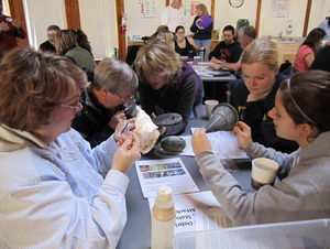
From left, Sam Case third-grade teacher Fanny Drews, Newport Intermediate fifth-grade teacher Christie Walker, Taft Elementary fifth-grade teacher Valerie Baker and sixth-grade teachers Beth Parsons and Kara Allen identify microbes that live on marine debris. Photo courtesy of NewsGuard of Lincoln County, Oregon.
Teachers and informal educators engage with CMOP in a variety of ways. Teachers access data through user-friendly modules that can be used to plot time series and explore correlations between estuary variables. As an example, teachers could design an experiment that demonstrates how red water blooms influence dissolved oxygen levels, using CMOP’s models to explore various scenarios. CMOP offers a regularly updated activity archive on the CMOP website (Science Activities and Curriculum URL). Lessons are designed for adaptability between age groups and data are appropriate for math, science, and social science classrooms. These lesson plans align with the essential principles of Ocean Literacy and the Next Generation Science Standards (Ocean Literacy Guide URL) and were generated through an interactive teacher professional development workshop. Teachers can engage in individualized internships of their own, conducting original research within CMOP teams and incorporating their experiences into their classroom curricula.
A three-year collaboration of the Oregon Coast Aquatic and Marine Partnership (OCAMP) consisting of CMOP, the Lincoln County School District, Hatfield Marine Science Center, Oregon Sea Grant, Oregon Department of Fish and Wildlife/Oregon Hatchery Research Center, the Oregon Coast Aquarium, and the Bureau of Land Management’s Yaquina Head Outstanding Natural Area aimed to provide teachers with the tools needed to carry out meaningful field experiences and inquiry driven learning while improving ocean literacy during sustained, year-round professional development colloquia as well as summer workshops. A follow-up program, entitled the Oregon Coast Regional STEM Center, extended OCAMP’s partnership to include Tillamook School District, Western Oregon University, and a variety of local businesses and agencies, and seeks to support teachers in their use of problem-based learning to improve student outcomes in STEM disciplines through engagement and the incorporation of 2lst century skills. The latter program is being carried out in a blended model of professional development, with in-person and web-based activities. CMOP can also engage with an entire school community through the CMOP- School Collaboratories (CSC) program. Cohorts of teachers from CSC partner schools can engage with CMOP to develop an integrated curriculum that emphasizes an inter-connected environment (Hugo et al. 2013).
THE VALUE OF A SCIENCE AND TECHNOLOGY CENTER
 The structure of the National Science Foundation Science and Technology Center program (NSF STC) has greatly enabled the development of this educational pathway through the decade-long investment in exploratory yet rigorous, potentially transformative science. lt is this structure that allows CMOP to expose students to a multi-disciplinary approach, engaging scientists from a broad range of relevant fields and from several collaborating universities, as well as practitioners from many state, federal and tribal agencies and from industry. The longevity of the STC investment has also contributed to our ability to effectively engage in sustained efforts to broaden participation among Native American, Alaska Native (Bueno Watts and Smythe 2015) and other groups underrepresented in Science, Technology, Engineering and Math (STEM) disciplines.
The synergy among anchoring academic partners (OHSU, Oregon State University and University of Washington, in the case of CMOP) is critically important to the success of a STC. Also critical is the engagement of regional stakeholders, which offer a natural, realistic, enriching and often pressing context for our science and education programs. For instance, Native American tribes of the Columbia River have historically been active and effective stewards of the land, water and natural resources in the basin. The Columbia River lnter-Tribal Fish Commission (CRITFC) has partnered with CMOP to identify potential threats to salmon and lamprey through investigation of factors that influence habitat quality. This collaboration has effectively engaged several Native American students in the CMOP education pathway and has also educated non-Native students on tribal cultures and natural resource management strategies.
DEVELOPING THE COASTAL MARGIN WORKFORCE
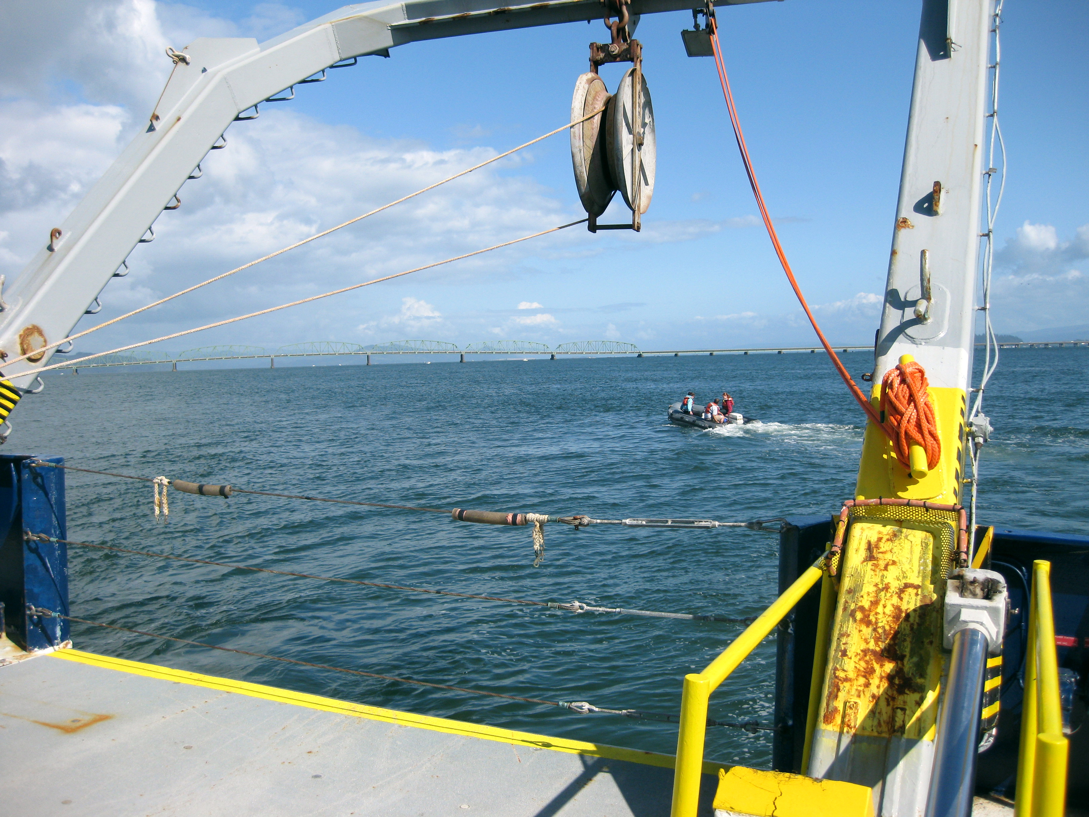
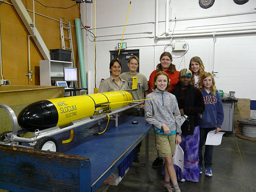
 CMOP students are engaged at all levels of the collaboratory. They participate in the development of sensors and models, and take active part in oceanographic cruises that might range from research to mariner-training vessels, autonomous underwater vehicles (Figure 3) and even kayaks (Rathmell et al. 2013). CMOP students, from high school to graduate, conduct research projects that relate to important biological hotspots, attempting holistic descriptions of their underlying physics and biogeochemistry that cover gene-to-climate scales. Students learn, shoulder-to-shoulder with researchers and practitioners, how to characterize, predict and inter-relate processes driving estuarine hypoxia and acidification. plankton blooms, and the biogeochemistry of lateral bays and of estuarine turbidity maxima (ETM)-turbid water regions located at the heads of coastal plain estuaries near the freshwater/saltwater interface. CMOP students also gain an understanding of broad topics that provide context to CMOP research science initiatives, such as global nutrient cycles, climate change, managing natural resources, mitigating natural hazards, and protecting fragile ecosystems.
Within the curriculum or with their mentor teams, students conduct fieldwork in the Columbia River estuary and in the coastal waters of Oregon and Washington using a variety of approaches, ranging from simple  river-front water sampling from a dock to participation in major research campaigns aboard University-National Oceanographic Laboratory System (UNOLS) vessels. Students gain hands-on experience within laboratories, using state-of-the-art equipment such as imaging flow cytometers (FlowCAM), an Environmental Sample Processor (ESP), a Conductivity, Temperature, and Depth Sensor (CTD), or a Scanning Electron Microscope. Students also gain exposure to the “Virtual Columbia River,” a data-rich simulation environment that offers multiple representations of circulation and ecological processes, including their variability and change across river-to-shelf scales (Virtual Columbia River URL). The models that form the Virtual Columbia River simulate estuarine conditions, enabling predictions of changing physical properties (tides, currents, salinity and temperature) and biogeochemical cycles (e.g., nitrogen and carbon) important to ecosystem management. Comparisons between field observations and model simulations allow for continued learning and refinement of the process.
INCORPORATING CMOP SCIENCE INTO THE CLASSROOM
 Curricula available on the CMOP website combine elements of coastal oceanography, environmental microbiology, biogeochemistry, computational sciences, and information technology. Student participants in K-12 activities have continued working with CMOP, ‘graduating” to more sophisticated, longer-term participation as undergraduate interns. Likewise, undergraduate interns have continued their research by matriculating into the CMOP-affiliated M.S./Ph.D. Environmental Science and Engineering degree program offered through the lnstitute of Environmental Health (IEH) at OHSU. IEH graduates have gone on to related careers in academia, private research, and with related federal and state agencies. To date, CMOP has served over 800 K-l2 students, over 70 teachers, over 100 undergraduate students, and has graduated 28 M.S. and Ph.D. students. CMOP students have graduated from the Environmental Science and Engineering Program at Oregon Health & Science University; the Ocean, Earth and Atmospheric Sciences Program at Oregon State University; the Computer Science program at Portland State University; the Marine Estuarine Environmental Sciences program at the University of Maryland; the Computer Science program at the University of Utah; the Physical Oceanography Program and the Biological Oceanography Program at the University of Washington. Students who have engaged in the CMOP Education “pathway” have become citizen scientists with a nuanced knowledge of coastal-margin science issues, and many have gained expertise and skills that have enabled them to contribute to a growing professional workforce in coastal margin science.
For middle- and high-school students, CMOP offers classes. day-camps and high-school internships in partnership with Saturday Academy, a non-profit organization dedicated to providing hands-on, in-depth learning and problem-solving activities. Past topics have included microbiology, marine biology, oceanography, and ocean technology. The curriculum is designed to enable students to easily identify the importance of coastal-margin related issues to their own academic interests and personal lives.
Undergraduate interns join CMOP mentor teams, which include a “Frontline Mentor” and a “senior Scientist.” The Frontline Mentor-typically a graduate student, staff member or post-doctoral fellow-establishes a project relevant to one or more CMOP research initiative. The Senior Scientist mentor provides guidance and ensures academic caliber. Over the course of the ten-week program, interns gain autonomy within their mentor teams as they gain contextual knowledge and skills. lnterns regularly interact with each other and with other CMOP participants through professional development seminars encompassing scientific themes, career opportunities and scientific ethics. lnterns visit sites along the river from Bonneville Dam to downtown Portland and to the mouth of the Columbia River estuary, to gain a first-hand understanding and appreciation of the complex interactions of biological, chemical, and physical processes. lnterns document their work through a daily lab notebook, a weekly blog (Undergraduate lnternships URL), a final presentation and a synthesizing paper. lntern research projects have been thoroughly incorporated into CMOP research; interns have co-authored CMOP publications in peer-reviewed journals (Publications URL) and have presented at national and international conferences (Presentations URL).
ASSESSING IMPACT
The CMOP Education program seeks to make full use of the resources available to this NSF STC to enable a wide range of teachers, students, and other users to learn more about and contribute to place-based knowledge of coastal margins. The University of Washington’s Office of Educational Assessment regularly evaluates the effectiveness of our program. Evaluations include surveys and focus groups with each participant cohort as well as follow-up surveys for longitudinal data. Data analyses demonstrate that high school and undergraduate participants in CMOP programs have increased interest in STEM education; increased confidence in their ability to engage in STEM research; enhanced relevant technical and professional skills, and, for undergraduate students, clarified research foci both within their degree programs and related to their decision of graduate programs. Eighty-seven percent of undergraduate survey respondents who obtained bachelor degrees went on to matriculate into STEM graduate programs, 4O% in fields related to their internships. All of these graduates agreed or strongly agreed that “Being part of the [CMOP] summer internship strengthened my application to this graduate degree program.”
ACKNOWLEDGEMENTS
CMOP is primarily supported by the National Science Foundation, through cooperative agreement OCE-O4246O2. Crant CEO-I034611 extended our CSC program to Native Alaskans.
REFERENCES
Baptista, A., Howe, B., Freire, J., Maier, D., & Silva, C. T. (2008).
Scientific exploration in the era of ocean observatories. Computing in Science & Engineering, l0 (3),53-58.
Barnes, C. A., Duxbury, A. C., and Morse, B. (1972). Circulation and selected properties of the Columbia River effluent at sea. ln: The Columbio River Estuory and Adjocent Oceon Woters: Bioenvironmental Studies, edited by A.T. Pruter and D.L. Alverson. Seattle: University of Washington Press, pp. 71-80.
Bueno Watts, N. & Smythe, W F. (2013). It takes a community to raise a scientist:A case for community-inspired research and science education in an Alaska Native community. Current: The Journal of Morine Educotion 2B(3).
Frontier Economics Limited. (2012). Exploring the links between woter ond economic growth: A report prepared for HSBC. London, England: Frontier Economics Limited.
Herfort, 1., Peterson, T. D., Prahl, F. C., McCue, L. A., Needoba, J. A., Crump, B. C., Roegner, C. C., Campbell, V., & Zuber, P. QO12). Red waters of Myrionecto rubrq are biogeochemical hotspots for the Columbia River estuary with impacts on primary/secondary productions and nutrient cycles. Estuories ond Coqsts,35 (3), B7B-891.
Hugo, R., Smythe, W., McAllister, S., Young, B., Maring, B. & Baptista, A. (2013). Lessons learned from a K-’12 geoscience education program in an Alaska Native community. Journal of Sustainability Education,5 (SSN 2-51:7452).
Ocean Literacy Cuide URL http:,/www.coexploration.orgl ocean literacy/documents/Ocea n LitC u ide_LettersizeV2.pdf
Presentations URL http://www.stccmop.orglknowledge_transfer/presentations
Publications URL http://www.stccmop.orglpublications
Rathmell, K., Wilkin, M., Welle, P., Mattson, T., & Baptista, A. (2015). A very smart kayak. Current: The Journal of Marine Education QB)3.
Roegner, C. C., Needoba, J. A., & Baptista, A. (20I). Coastal upwelling supplies oxygen-depleted water to the Columbia River estuary. PLoS ONE, 6 @), e18672.
doi:1O.137 1 /journal.pone.00l 8672
Science Activities and Curriculum URL http://www.stccmop.org/education/teacher/activityarchive
Undergraduate lnternships URL http://www.stccmop.org/education/undergraduate
Virtual Columbia River URL http://www.stccmop.org/datamart/virtualcolumbiariver
AUTHORS
Vanessa L. Green M.S. serves as Director of Student Development and Diversity at the NSF Science and Technology Center for Coastal Margin Observation and Prediction. Having earned a M.S. in Higher Education Administration she has focused her career on broadening participation and increasing engagement, persistence and retention among first-generation and underrepresented students in high school, undergraduate and graduate programs. She served as a founding faculty member and Dean of Students at the King George School in Vermont and served as a member of the Board of Trustees at Marlboro College. She currently serves on the Education and Outreach Steering Committee for the Center for Dark Energy Biosphere lnvestigations (C-DEBI).
Nievita Bueno Watts Ph.D. is a geotogist, science educator and Director of Academic Programs at the NSF Science and Technology Center for Coastal Margin Observation & Prediction. She conducts research on broadening the participation of underrepresented minorities in the sciences and serves on the Board of Directors of the Geoscience Alliance, a national organization dedicated to building pathways for Native American participation in the geosciences.
Karen Wegner MSW was rhe first Director for K-12 Education for the NSF Science and Technology Center for Coastal Margin Observation & Prediction. She brought years of experience as a wildlife biologist and environmental educator to CMOP. Along with education partners Saturday Academy and the SMILE Program she developed K-12 programs initially offered at CMOP. She credits the success of the K-12 program to the fantastic support offered by CMOP researches and students. Karen is now a Palliative Care Social Worker and Program Manager in Montana.
Michael Thompson Ph.D. is the Education and Outreach Coordinator at the NSF Science ahd Technology Center for Coastal Margin and Observation. He has an M.S. in Biochemistry and a PhD in Chemical Education with a focus in Engineering Education. He has been instrumental in the establishment of the EPICS High-school program, development and implementation of teacher training workshops, STEM learning communities for undergraduates, and service-learning experiences for high-school and undergraduate students.
Amy F. Johnson M.S, serves as the Managing Director for the NSF Science and Technology Center for Coastal Margin Observation and Prediction. Having earned an M.S. in Management in Science and Technology, she has years of experience managing in science and technology companies and education institutions. Prior to joining CMOP she was the Assistant Dean for Craduate Education at the OCI School of Science & Engineering at the Oregon Health & Science University.
Tawnya D. Peterson Ph.D. is an Assistant Professor in the Institute of Environmental Health at Oregon Health & Science University. She holds a Ph.D. in Biological Oceanography and carries out research that seeks to identify the factors that shape planktonic community diversity and function in aquatic systems. ln addition to scientific research, she is interested in the development and implementation of professional development programs for K-l2 teachers.
Antonio M. Baptista Ph.D. is a professor and director of the lnstitute of Environmental Health, Oregon Health & Science University and the director of the NSF Science and Technology Center for Coastal Margin Observation & Prediction. He has 25 years of experience in team science and graduate-level teaching, and uses leading edge coastal-margin science and technology as a catalyst for informed management decisions, workforce development and broadening participation.
PHOTO CREDITS
All Photos: Courtesy of CMOP staff member Jeff Schilling
Reprinted from Current, the Journal of the National Marine Education Association

by editor | Feb 23, 2015 | Environmental Literacy, Indigenous Peoples & Traditional Ecological Knowledge, Marine/Aquatic Education, Place-based Education, STEM
It Takes a Community to Raise a Scientist:
A Case for Community-Inspired Research and Science Education in an Alaskan Native Community
By Nievita Bueno Watts and Wendy F. Smythe
The quote, “lt takes a village to raise a child,” is attributed to African tradition and carries over to Alaskan Native communities as well (Hall, 2000). Without the support of their community and outside resources, Alaska Native children have a difficult time entering the world of science. Yet increasing the awareness of science, as a tool to help a tribal community monitor and maintain the health of their environment, introduces conflicts and misconceptions in context of traditional cultural practices. Rural communities depend upon traditional food harvested from the environment such as fish, wild game, roots, and berries. In many Native Alaskan villages the health of the environment equals the health of the people (Garza, 2001) . Integrating science with culture in pre-college education is a challenge that requires sensitivity and persistence.
 The Center for Coastal Margin Observation and Prediction (CMOP) is a multi-institutional, National Science Foundation (NSF) Science and Technology Center that takes an interdisciplinary approach to studying the region where the Columbia River empties into the Pacific Ocean. Two of CMOP’s focus areas are biogeochemical changes affecting the health of the coastal margin ecosystem, and socio-economic changes that might affect the lives of people who harvest and consume fish and shellfish.
The Columbia River waters touch the lives and livelihoods of many people, among them a large number of Pacific Northwest lndian tribes. These people depend on the natural and economic resources provided by the Columbia River. Native peoples from California through Alaska also depend on resources from their local rivers, and, currently, many tribes are developing-a workforce trained with scientific skills to manage their own natural resources in a way that is consistent with their traditional way of life. The relationship between Traditional Knowledge (TK) and practices, which are informed by centuries of observation, experimentation and carefully preserved oral records, and Western Science, which is deeply rooted in the philosophies and institutions of Europe, is often an uneasy one.
National progress is being made to open pathways for individuals from Native communities to Western Science higher education programs and back to the communities, where tribal members are empowered to evaluate and monitor the health of their environment. CMOP is part of this national movement. CMOP science is developing tools and techniques to observe and predict changes in the river to ocean system. CMOP education, an essential element of CMOB supports American lndian/Alaska Native students in pursuing academic and career pathways focusing on coastal margin sciences (Creen et al., 2013). One of CMOP’s initiatives is the CMOP- School Collaboratories (CSC) program.
CMOP-SCHOOL COLLABORATORIES
The CMOP-school Collaboratories (CSC) program is based on the idea that Science, Technology, Engineering, and Mathematics (STEM) pathway development requires an intensive and sustained effort to build relationships among science educators, students, school personnel, and the tribal community. The over-arching goal is to broaden participation in STEM disciplines. CMOP educators developed the CSC model that includes integration strategies for a community, development of appropriate lessons and field experiences and student action projects that connect local and traditional knowledge with science. Educational experiences are place- based, multi-disciplinary and culturally relevant. The objective is to open students’ minds to the reality of the need for scientists with many different world views and skill sets working together to address our planet’s pressing problems in a holistic manner. CMOP seeks to encourage these students to be part of that solution using both Traditional Knowledge and STEM disciplines.
The program encourages STEM education and promotes college preparatory awareness. This CSC program has three unique characteristics: it introduces coastal margin science as a relevant and viable field of employment; it integrates STEM learning with Traditional Knowledge; and, it invites family and community members to share science experiences. The example presented in this article describes a four-year program implemented in a small village in Southeast Alaska, 200 miles from the capital city of Juneau.
Figure 1: Students, scientists, a cultural expert. and a teacher with scientific equipment used to collect data from the river.
ALASKA NATIVE VILLAGE CASE STUDY
 Wendy Smythe, a CMOP doctoral candidate and principal investigator for an NSF Enhancing Diversity in the Geosciences (OEDC) award, is an Alaska Native Haida. As she advanced in her own education, she wanted to share what she had learned with the youth of her tribal community, striving to do so with the blessing of the tribal Elders, and in a way that respected the Traditional Knowledge of the Elders. Dr Bueno Watts is a mentor and expert on broadening participation. She acts in an advisory capacity on this project.
The village school consists of l5 staff members and 50 K-l2 students, with the school experiencing high administration turnover rates. ln the first two years of the program we recruited non-native graduate students to participate in the CSC program. This effort provided them experience working in Native communities. ln the last two years we recruited Native American undergraduate interns to teach lessons, assist with field activities and provide students with the opportunity to become familiar with Native scientists [Figure 1]. lnterns formed part of the science team.
STEPS TO GAIN ENTREE TO A VILLAGE
The community must support the concept to integrate science education with traditional practices. Even for this Alaska Native (Smythe), the process of building consensus from the tribe and gaining approval from the Elders and school district for the program was a lengthy one. The first step required letters of support from school district and tribal leaders. The difference in geographical locations proved difficult until Smythe was able to secure an advocate in the tribe who spoke for her at tribal meetings. Face-to-face communications were more successful than distance communications. Persistence proved to be the key to achieving success at getting the consensus of community leaders and school officials’ support. This was the top lesson of l0 learned from this project (Table l).
Traveling to the school to set up the program is no small feat and requires extensive coordination of transportation and supplies. A typical trip requires a day-long plane ride, overnight stay in a nearby town to prepare and gather supplies, a three-hour ferry ride, acquisition of a rental truck and a one-hour drive. Accommodations must be made to board with community members.
The development of appropriate lessons for the curriculum engaged discussions with tribal Elders and community Ieaders on an individual basis. Elders agreed to provide videoed interviews and were given honoraria as a thank you for their participation. Smythe asked the Elders what scientists could do to help the community, what stories can be used, where students and educators could work in the community to avoid intruding on sacred sites, and what information should not be made public. Once Elders agreed to provide interviews and share stories, other community members began to speak about their lives and concerns. This included influence of boarding schools, Iife as it was in the past, and changes they would like to see within the community. This was a significant breakthrough.
Table l . Lessons Learned: ten things to consider when developing a science program with Native communities
1. Persistence is key.
2. Face to-face communication is vital and Lakes time.
3. A community advocate with influence and respect in the community is critical.
4. Consult with the Elders first. They have their finger on the pulse of the community and are the center “of the communication network. Nothing happens without their approval. Find out what it is okay to talk about and where your boundaries are and abide by them. lnclude funds for honorariums in your proposal. Elders’ time and knowledge is valuable and they should be compensated as experts.
5. Partner with individuals or groups, such as the Department of Natural Resources.
6. Find a relevant topic. Be flexible with your curriculum choice. It must reflect the needs and interests of the community and the abilities of the teacher you are working with.
7 . Be prepared, bring supplies with you. Ship items in advance if going to a remote location
8. Have the ability to provide individual instruction for students who need it to prepare projects and practice giving presentations.
9. lnvolve the community. Hold events in a community center to encourage everyone to attend.
10. View your involvement as a long-term investment in a committed community relationship.
 ln addition to the Elders, support was needed from a natural resources representative who functioned as a liaison between our group and the community members. This person’s role is found in most villages and could be the head of the Department of Natural Resources or a similar tribal agency that oversees fish, wildlife, and natural resources. This person provides a critical link between the natural environment and the community. The next step is to go in the field with the natural resources representative, science teachers, EIders, and interested students to identify a meaningful focus for the community. lnitially we focused the project with a scientist’s view of teaching microbiology and geology of mineral deposition in a river ecosystem. However, the team found community interest low and no enthusiasm for this project.
Upon our return to the village, the team and CMOP educators found the focus, almost by accident. We were intrigued by “boil water” notices posted both at the home in which we were staying and on the drinking fountains at the school: The students were all talking about water, as were the Elders. It was clear that the community cared about their water quality. The resulting community-inspired research educational plan was based on using aquatic invertebrate bioindicators as predictors of water quality (Adams, Vaughan & Hoffman Black, 2003). This student project combined science with community needs (Bueno Watts, 2011).
CURRICULUM LESSONS
The first classroom lessons addressed water cycle and watershed concepts (Wolftree, 2OO4), which were followed by a field lesson on aquatic invertebrates. Students sampled different locations in an effort to determine biodiversity and quantity of macroinvertebrates. While students were sitting at the river’s edge, the site was described in the students’ Alaska Native tongue by a cultural expert, and then an English translation was provided. This introduced the combination of culture and language into the science lesson.
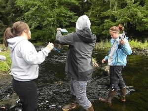 Figure 2: Students use data loggers to collect data on temperature, pH, and location.
The village water supply comes from a river that runs through the heart of the community. Thus, this river was our primary field site from which students collected water for chemical sampling and aquatic invertebrates using D-loop nets. Physical and chemical parameters of the river were collected using Vernier LabQuest hand-held data loggers. Students recorded data on turbidity, flow rate, temperature, pH, and pinpointed locations using CPS coordinates (Figure 2].
 Aquatic invertebrate samples were sorted, classified, counted, recorded, and examined through stereoscopes back in the classroom. Water chemistry was determined by kits that measured concentrations of alkalinity, dissolved oxygen, iron, nitrate/nitrite, dissolved carbon dioxide, and phosphate.
Microbiology assessments were conducted in an effort to detect fecal coliform (using m_FC Agar plates). Students tested water from an estuary, river, drinking fountain, and toilet. Results from estuarine waters showed a high number of fecal coliform, indicating that a more thorough investigation was warranted While fecal coliform are non-disease causing microorganisms, they originate in the intestinal tract, the same place as disease causing bacteria, and so their presence is a bioindicator of the presence of human or animal wastes (Figure 3).
 Students learned that the “dirty water” they observed in the river was actually the result of a natural process of acidic muskeg fluids dissolving iron minerals in the bedrock, no health danger. The real health threat was in the estuarine shellfish waters. Students shared all of their results with their families, after which community members began to approach the CMOP science team with questions about the quality of their drinking water. The community was relieved to find that the combined results of aquatic invertebrate counts and water chemistry indicated that the water flowing through their town was healthy. However they were concerned about the potential contamination as indicated by fecal coliform counts in the local estuary where shellfish were traditionally harvested.
ln the second year, a curriculum on oceanography developed by another STC, the Center for Microbial Oceanography: Research and Education (C-MORE) was introduced (Bruno, Wiener, Kimura & Kimura, 2011). Oceanography lessons focused on water density as a function of salinity and temperature, ocean currents, phytoplankton, and ocean acidification, all areas of research at CMOP. Additional lessons used local shipworms, a burrowing mollusk known to the community, as a marine bioindicator (CMOP Education, 2013). Students continued to conduct bioassessments of local rivers and coastal marine waters.
 Figure 3: Students sort and count aquatic invertebrates as a bioindicator of river health.
Students used teleconferencing technology to participate in scanning electron microscope (SEM) session with a scientist in Oregon who had their samples of aquatic invertebrates. Students showcased their experiments during parent day. Five students (l0%) had parents and/or siblings who attended the event.
SHARING KNOWLEDGE
As a reward for participation in the science program, two students were chosen to attend the American lndian Science and Engineering Society (AISES) 2009 conference in Oregon. Travel expenses were shared between the school, CSC program, and the tribe. ln the following three years an additional ten students attended the AISES conference and presented seven science research posters in New Mexico. Minnesota and Alaska. ln 2012, one student won 3rd place for her shipworm poster presentation (Figure 5). These conference presentations enabled some students to take their first trip out of Alaska.
ln May 20ll the first Science Symposium for grades K-12 allowed students to share their science projects with parents, Elders, and tribal community members. Both students and teachers were prepared on how to do a science fair project. Work with students had to be accomplished on a one-on-one basis, and members of the team were paired with students to assist with completing projects and polishing presentations. Students were not accustomed to speaking publicly, so this practice was a critical step.
The event was held at the local community center, which encouraged Elders and other community members to attend.
Elders requested a public education opportunity to teach the community about watersheds and the effects of logging. Our team incorporated this request into the science symposium. Students led this project by constructing a 5D model of the watershed for display. People could simulate rainfall, see how land use affects runoff and make runoff to river estuary connections. Scientists conducted hands-on demonstrations related to shipworms, local geology, ocean acidification and deepsea research. Language and culture booths were also included. During the symposium, a video of one of the interviews we had conducted with an Elder was shown as a memorial to his passing. The symposium was considered a huge success and was attended by 35 students and 50 community members.
 COMMUNITY RESPONSE
The CSC program garnered results that could not have been predicted at the outset. For example, the tribe requested our input when deciding which students should attend a tribal leadership conference and summer camp. Three student interns participated in a collaborative project with the tribe to conduct bio-assessment studies of local rivers and a key sockeye breeding lake. lnterns operated a remotely operated underwater vehicle (ROV) for data collection, resulting in video documentation of the salmon habitat. ln addition to the bio-assessment, the interns conducted interviews with Elders about the rivers in the monitoring project. The results of this study were used to stop logging around sockeye spawning habitat and to ban the harvest of shellfish from contaminated parts of the estuary. Now the tribe is monitoring rivers on its own. ln the near future CMOP plans to install a sensor that can be monitored remotely, and to train people to read and interpret the data.
CONCLUSION
Community-inspired research often produces a ripple effect of unforeseen results. ln this case, inclusion of Elders in the design and implementation of the project produced large scale buy-in from community members at all age levels. Consequently, in a village where traditionally students did not think about education beyond high school, we have had two students attend college, two students attend trade school, five students receive scholarships, and eight Native interns conducting science or science education in the community. And, given the low numbers of Alaska Natives pursuing careers in science, we find those numbers to be remarkable.
REFERENCES
Adams, J., Vaughan, M., & Hoffman Black, S. (200i). Stream Bugs as Biomonitors: A Guide to Pacific Northwest Macroinvertebrate Monitoring and Identification. The Xerces Society. Available from: http://www.xerces.org/identification-guides/#
Bruno, B. C., Wiener, C., Kimura, A., & Kimura, R. (2011). Ocean FEST: Families exploring science together. Journal of Geoscience Education, 59, 132.1.
Bueno Watts, N. (20,1 1). Broadening the participation of Native Americans in Earth Science. (Doctoral dissertation).
Retrieved from Pro-Quest. UMI Number: 3466860. URL http ://repository.asu.edu/items / 9 438
Center for Coastal Margin Observation & Prediction. QO13). Shipworm lesson URL http://www.stccmop”org/ education/k1 2/geoscience/shipworms
Carza, D. (200.l). Alaska Natives assessing the health of their environment. lnt J Circumpolar Health. 6O@):a79-g6.
Creen, V., Bueno Watts, N., Wegner, K., Thompson, M., Johnson, A., Peterson, T., & Baptista, A. (201i). Coastal Margin Science and Education in the Era of Collaboratories. Current: The Journal of Marine Education. 28(3).
Hall, M. (2000). Facilitating a Natural Way: The Native American Approach to Education. Creating o Community of Learners: Using the Teacher os Facilitator Model. National Dropout Prevention Center. URL http://www. n iylp.org/articles/Facilitating-a-Natural-Way.pdf
Wolftree, lnc. (200a). Ecology Field Cuide: A Cuide to Wolftree’s Watershed Science Education Program, 5th Edition. Beavercreek, OR: Wolftree, lnc. URL http://www. beoutside.org/PUBLICATIONS/EFCEnglish.pdf
ADDITIONAL RESOURCES
The educational resources of CMOP are available on their website : U R L http ://www. stccm o p. o rg / education / kl 2
ACKNOWLEDGMENTS
CMOP is funded by NSF through cooperative agreement OCE- 0424602. Smythe was also supported by NSF grant CEO-I034611. We would like to thank Dr. Margo Haygood, Carolyn Sheehan, and Meghan Betcher for their assistance and guidance with the shipworm project. We would like to thank the Elders and HCA for their guidance, advice and encouragement throughout this program
Nievita Bueno Watts, Pn.D. is a geologist, science educator, and Director of Academic programs at the NSF Science and Technology Center for Coastal Margin Observation & Prediction (CMOP). She conducts research on broadening the participation of underrepresented minorities in the sciences and serves on the Board of Directors of the Geoscience Alliance, a national organization dedicated to building pathways for Native American participation in the Earth Sciences.
Wendy F. Smythe is an Alaska Native from the Haida tribe and a Ph.D. candidate at the NSF Science and Technology Center for Coastal Margin Observation & Prediction. She runs a geoscience education program within her tribal community in Southeast Alaska focused on the incorporation of Traditional Knowledge into STEM disciplines.